IMAGES TAKEN NEAR TO
St. Bernards Road, COALVILLE, LE67 5GU

Introduction

This page details the photographs taken nearby to St. Bernards Road, LE67 5GU by members of the Geograph project.

The Geograph project started in 2005 with the aim of publishing, organising and preserving representative images for every square kilometre of Great Britain, Ireland and the Isle of Man.

There are currently over 7.5m images from over14,400 individuals and you can help contribute to the project by visiting https://www.geograph.org.uk

Image Map


Images are licensed for reuse under creativecommons.org/licenses/by-sa/2.0
Notes
  • Clicking on the map will re-center to the selected point.
  • The higher the marker number, the further away the image location is from the centre of the postcode.

Image Listing (8 Images Found)

Images are licensed for reuse under creativecommons.org/licenses/by-sa/2.0
Image
Details
Distance
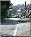
1
Leicester Road, Whitwick
Image: © Mat Fascione Taken: 9 Jun 2007
0.14 miles
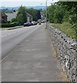
2
Leicester Road in Whitwick
Close to the entrance to Forest Rock Wood.
Image: © Mat Fascione Taken: 26 Jun 2010
0.15 miles
3
Leicester Road, Whitwick
Forest Rock wood is on the left.
Image: © Mat Fascione Taken: 9 Jun 2007
0.16 miles
4
Leicester Road entrance to Forest Rock Wood
The following information is from a nearby notice board: Forest Rock Wood has been planted as a result of a partnership between the National Forest Company and ARC Central to provide an important leisure and educational facility in NW Leicestershire. Funding from the National Forest Company has enabled ARC Central to plant some 15000 trees and shrubs in Forest Rock Wood. Eventually this 10 hectare site will merge with nearby woodland and additional valuable habitat wildlife will develop. Approximately 80% of the trees are native broadleaf, such as Oak, Ash, Cherry, Rowan and Field Maple, with the remainder being more exotic species such as Red and Grey Alder, to give early visual impact and protect the slower growing broadleaves. During the past 12 years, ARC has planted in excess of 1.3 million trees as part of its restoration of worked out sites. This joint venture is another valuable example of ARC's long-standing commitment to responsible restoration. There are 1.1 kilometres of new public footpath within this woodland, linking up with existing routes such as the Leicestershire Geological Trail, which gives excellent views into Whitwick Quarry. All paths in Forest Rock Wood converge on the highest point - 200 metres above sea level, with excellent views to the south and west. A stone circle has been built from Whitwick granite with the centre feature a massive ten tonne stone.
Image: © Mat Fascione Taken: 26 Jun 2010
0.20 miles
5
View from Lees Crescent
Image: © Dave Thompson Taken: 28 Aug 2020
0.21 miles
6
Houses on Hall Lane, Whitwick
Image: © JThomas Taken: 21 Jul 2016
0.22 miles
7
Bus stop and shelter on Hall Lane
Image: © JThomas Taken: 21 Jul 2016
0.23 miles
8
Arriva bus on Hall Lane, Whitwick
On the 29A route - Coalville to Leicester.
Image: © JThomas Taken: 21 Jul 2016
0.23 miles