IMAGES TAKEN NEAR TO
Curlew Close, COALVILLE, LE67 4BD
Introduction
This page details the photographs taken nearby to Curlew Close, LE67 4BD by members of the Geograph project.
The Geograph project started in 2005 with the aim of publishing, organising and preserving representative images for every square kilometre of Great Britain, Ireland and the Isle of Man.

There are currently over 7.5m images from over14,400 individuals and you can help contribute to the project by visiting https://www.geograph.org.uk
Image Map
Images are licensed for reuse under creativecommons.org/licenses/by-sa/2.0
Notes
- Clicking on the map will re-center to the selected point.
- The higher the marker number, the further away the image location is from the centre of the postcode.
Image Listing (10 Images Found)
Images are licensed for reuse under creativecommons.org/licenses/by-sa/2.0
Image
Details
Distance
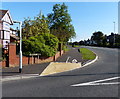
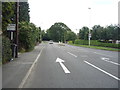
1
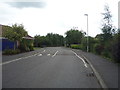
Buckingham Road, Coalville
Looking south east.
Image: © JThomas
Taken: 21 Jul 2016
0.17 miles
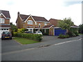
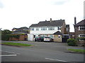
3
Houses along Stephenson Way in Coalville
Image: © Mat Fascione
Taken: 29 Sep 2013
0.20 miles
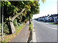
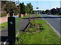
10
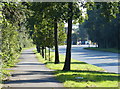
Footpath along Stephenson Way in Coalville
Image: © Mat Fascione
Taken: 29 Sep 2013
0.24 miles