IMAGES TAKEN NEAR TO
Beveridge Lane, COALVILLE, LE67 1TB
Introduction
This page details the photographs taken nearby to Beveridge Lane, LE67 1TB by members of the Geograph project.
The Geograph project started in 2005 with the aim of publishing, organising and preserving representative images for every square kilometre of Great Britain, Ireland and the Isle of Man.

There are currently over 7.5m images from over14,400 individuals and you can help contribute to the project by visiting https://www.geograph.org.uk
Image Map
Images are licensed for reuse under creativecommons.org/licenses/by-sa/2.0
Notes
- Clicking on the map will re-center to the selected point.
- The higher the marker number, the further away the image location is from the centre of the postcode.
Image Listing (6 Images Found)
Images are licensed for reuse under creativecommons.org/licenses/by-sa/2.0
Image
Details
Distance
4
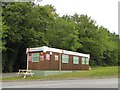
Diane's Food Emporium by A511
A snack bar at the end of a lay-by by Bardon Road
Image: © David Smith
Taken: 12 Jun 2015
0.19 miles
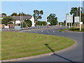
5
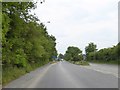
Start of dual carriageway on A511 Bardon Road
Image: © David Smith
Taken: 12 Jun 2015
0.19 miles
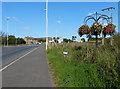
6
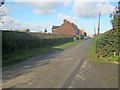
East Lane
Looking north-west along East Lane, which appropriately flanks the east side of the Bardon industrial estate.
Image: © Trevor Rickard
Taken: 6 Nov 2010
0.21 miles