IMAGES TAKEN NEAR TO
Wood Road, COALVILLE, LE67 1GY
Introduction
This page details the photographs taken nearby to Wood Road, LE67 1GY by members of the Geograph project.
The Geograph project started in 2005 with the aim of publishing, organising and preserving representative images for every square kilometre of Great Britain, Ireland and the Isle of Man.

There are currently over 7.5m images from over14,400 individuals and you can help contribute to the project by visiting https://www.geograph.org.uk
Image Map
Images are licensed for reuse under creativecommons.org/licenses/by-sa/2.0
Notes
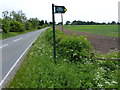
- Clicking on the map will re-center to the selected point.
- The higher the marker number, the further away the image location is from the centre of the postcode.
Image Listing (12 Images Found)
Images are licensed for reuse under creativecommons.org/licenses/by-sa/2.0
Image
Details
Distance
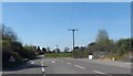
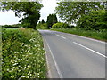
6
View south along B585
Lodge Farm in the background.
Image: © Andrew Tatlow
Taken: 25 Apr 2006
0.20 miles
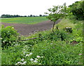
7
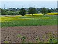
Crop of oil seed rape south of Wood Road
Image: © Mat Fascione
Taken: 16 Jun 2013
0.21 miles
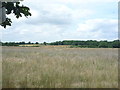
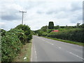
10
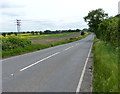
South along the B585 Wood Road
Heading towards the village of Nailstone.
Image: © Mat Fascione
Taken: 16 Jun 2013
0.22 miles