IMAGES TAKEN NEAR TO
Moorfields, LEICESTER, LE5 1NE
Introduction
This page details the photographs taken nearby to Moorfields, LE5 1NE by members of the Geograph project.
The Geograph project started in 2005 with the aim of publishing, organising and preserving representative images for every square kilometre of Great Britain, Ireland and the Isle of Man.

There are currently over 7.5m images from over14,400 individuals and you can help contribute to the project by visiting https://www.geograph.org.uk
Image Map
Images are licensed for reuse under creativecommons.org/licenses/by-sa/2.0
Notes
- Clicking on the map will re-center to the selected point.
- The higher the marker number, the further away the image location is from the centre of the postcode.
Image Listing (14 Images Found)
Images are licensed for reuse under creativecommons.org/licenses/by-sa/2.0
Image
Details
Distance
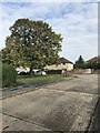
6
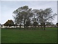
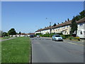
Moorfields Recreation Ground
Looking towards Nether Hall Road
Image: © Tim Glover
Taken: 31 Oct 2016
0.21 miles
7
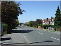
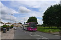
View west along Scraptoft Lane
At the junction with New Romney Crescent.
Image: © Mat Fascione
Taken: 21 Sep 2014
0.21 miles
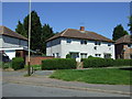
9
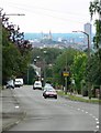
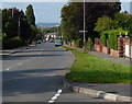
Scraptoft Lane, Leicester
Looking west across the Leicester skyline.
Image: © Mat Fascione
Taken: 17 Jun 2007
0.22 miles