IMAGES TAKEN NEAR TO
Lintlaw Close, LEICESTER, LE4 7YH
Introduction
This page details the photographs taken nearby to Lintlaw Close, LE4 7YH by members of the Geograph project.
The Geograph project started in 2005 with the aim of publishing, organising and preserving representative images for every square kilometre of Great Britain, Ireland and the Isle of Man.

There are currently over 7.5m images from over14,400 individuals and you can help contribute to the project by visiting https://www.geograph.org.uk
Image Map (Loading...)


Getting Data...Please wait
Leaflet Map data © OpenStreetMap
Images are licensed for reuse under creativecommons.org/licenses/by-sa/2.0
Notes
- Clicking on the map will re-center to the selected point.
- The higher the marker number, the further away the image location is from the centre of the postcode.
Image Listing (14 Images Found)
Images are licensed for reuse under creativecommons.org/licenses/by-sa/2.0
Image
Details
Distance
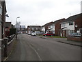
1
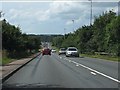
View west from the railway bridge, Troon Way
Image: © Peter Whatley
Taken: 28 Jul 2013
0.06 miles
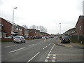
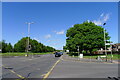
2
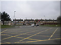
Junction of Nicklaus Road and Troon Way, Rushey Mead
Looking across Troon Way towards the junction of Nicklaus Road and Gleneagles Avenue.
Image: © Richard Vince
Taken: 11 Mar 2017
0.10 miles
3
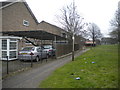
Footpath to Archer Close, Rushey Mead
From Nicklaus Road.
Image: © Richard Vince
Taken: 11 Mar 2017
0.11 miles
5
Archer Close, Rushey Mead
Looking towards Trevino Drive.
Image: © Richard Vince
Taken: 11 Mar 2017
0.12 miles
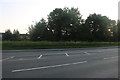
6
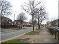
Nicklaus Road, Rushey Mead
Seen from just north of the junction with Troon Way.
Image: © Richard Vince
Taken: 11 Mar 2017
0.13 miles
7
Troon Way, Rushey Mead
Looking towards Badminton Road behind the fence
Image: © David Howard
Taken: 20 Sep 2020
0.14 miles
8
Trevino Drive, Rushey Mead
Seen from the junction with Archer Close.
Image: © Richard Vince
Taken: 11 Mar 2017
0.15 miles
9
Nicklaus Road joining Troon Way, Leicester
Troon Way: part of Leicester's Outer Ring Road
Image: © Tim Heaton
Taken: 10 May 2022
0.16 miles
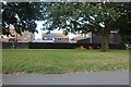
10
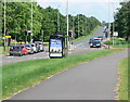
Bus shelter along Troon Way
Part of Leicester outer ring road.
Image: © Mat Fascione
Taken: 4 Jun 2012
0.16 miles