IMAGES TAKEN NEAR TO
Ferrous Close, LEICESTER, LE4 6EJ
Introduction
This page details the photographs taken nearby to Ferrous Close, LE4 6EJ by members of the Geograph project.
The Geograph project started in 2005 with the aim of publishing, organising and preserving representative images for every square kilometre of Great Britain, Ireland and the Isle of Man.

There are currently over 7.5m images from over14,400 individuals and you can help contribute to the project by visiting https://www.geograph.org.uk
Image Map (Loading...)


Getting Data...Please wait
Leaflet Map data © OpenStreetMap
Images are licensed for reuse under creativecommons.org/licenses/by-sa/2.0
Notes
- Clicking on the map will re-center to the selected point.
- The higher the marker number, the further away the image location is from the centre of the postcode.
Image Listing (29 Images Found)
Images are licensed for reuse under creativecommons.org/licenses/by-sa/2.0
Image
Details
Distance
3
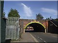
Bridge SPC5/10 carries the Midland main line over Hammercliffe Road
Image: © Tim Glover
Taken: 24 Aug 2016
0.14 miles
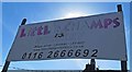
4
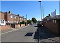
Carter Street southwards
Image: © Andrew Tatlow
Taken: 22 Jun 2018
0.14 miles

7
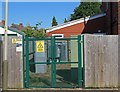
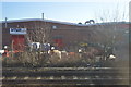
Electricity substation 33D3092 CARTER STREET
The OS Grid Line cuts across the compound from the front right corner to the back left corner!
Image
Image
Image: © Andrew Tatlow
Taken: 22 Jun 2018
0.16 miles

9
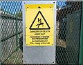
Sign at electricity substation 33D3092 CARTER STREET
Image: © Andrew Tatlow
Taken: 22 Jun 2018
0.16 miles
10
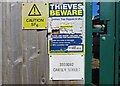
Notices at electricity substation 33D3092 CARTER STREET
Image: © Andrew Tatlow
Taken: 22 Jun 2018
0.16 miles