1
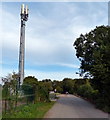
Mobile phone mast along Meadow Lane
This lane in Birstall leads to the Watermead Country Park North.
Image: © Mat Fascione
Taken: 5 Oct 2014
0.13 miles
2
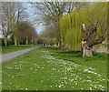
Path and cycleway along the River Soar
The path is heading towards Watermead Country Park North.
Image: © Mat Fascione
Taken: 30 Mar 2014
0.16 miles
3
Flooded path in the Watermead Country Park
The River Soar has burst its banks.
Image: © Mat Fascione
Taken: 25 Nov 2012
0.16 miles
4
Green Route 1 beside the River Soar
Image: © Tim Glover
Taken: 18 Jul 2015
0.16 miles
5
Path along the River Soar at Birstall
Image: © Mat Fascione
Taken: 27 Oct 2019
0.17 miles
6
Meadow Lane Playing Fields
Image: © Wesley Trevor Johnston
Taken: 14 Oct 2007
0.17 miles
7
River Soar near Birstall in Leicestershire
The River Soar is seen here, looking downstream about half a mile north of Birstall Lock. The river flows by and through the extensive Watermead Country Park for about four miles north of Leicester. There are many large lakes which are former gravel pits. For some sections, the navigation reverts to canalised status, part of the Grand Union Canal (Leicester Section). https://www.leicscountryparks.org.uk/watermead-visitor-information/
https://en.wikipedia.org/wiki/Watermead_Country_Park
Image: © Roger Kidd
Taken: 26 Aug 2013
0.17 miles
8
River Soar near Birstall in Leicestershire
The River Soar is seen here, looking downstream about half a mile north of Birstall Lock. The river flows by and through the extensive Watermead Country Park for about four miles north of Leicester. There are many large lakes which are former gravel pits. For some sections, the navigation reverts to canalised status, part of the Grand Union Canal (Leicester Section). https://www.leicscountryparks.org.uk/watermead-visitor-information/
https://en.wikipedia.org/wiki/Watermead_Country_Park
Image: © Roger Kidd
Taken: 26 Aug 2013
0.18 miles
9
Wanlip Lane Birstall - Renewal of Gas Mains
Thousands of yards of gas mains are being replaced around Birstall for some weeks now, and though inconvenient, this essential work has been carried out quite efficiently without major problems to residents. Motorists are even learning to give way to each other!
Image: © Wesley Trevor Johnston
Taken: 18 Mar 2009
0.19 miles
10
Bus on Wanlip Lane, Birstall
First Leicester 66320, a Volvo B7L/Wright Eclipse, lays over at the terminus of route 70 from Blackmore Drive via Leicester city centre.
Image: © Richard Vince
Taken: 13 Oct 2007
0.20 miles


