IMAGES TAKEN NEAR TO
Boston Road, LEICESTER, LE4 1AA
Introduction
This page details the photographs taken nearby to Boston Road, LE4 1AA by members of the Geograph project.
The Geograph project started in 2005 with the aim of publishing, organising and preserving representative images for every square kilometre of Great Britain, Ireland and the Isle of Man.

There are currently over 7.5m images from over14,400 individuals and you can help contribute to the project by visiting https://www.geograph.org.uk
Image Map
Images are licensed for reuse under creativecommons.org/licenses/by-sa/2.0
Notes
- Clicking on the map will re-center to the selected point.
- The higher the marker number, the further away the image location is from the centre of the postcode.
Image Listing (30 Images Found)
Images are licensed for reuse under creativecommons.org/licenses/by-sa/2.0
Image
Details
Distance
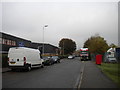
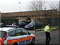
5
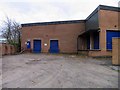
Delivery bay
These premises did not look occupied.
Image: © Andrew Tatlow
Taken: 13 Nov 2012
0.10 miles
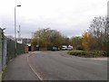
6
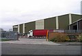
Artisan
Web offset printing specialist.
Image: © Andrew Tatlow
Taken: 13 Nov 2012
0.11 miles
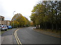
7
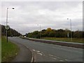
Anstey Lane towards Leicester
The boundary of the Leicester Unitary Authority is marked by the sign on the left.
Image: © Andrew Tatlow
Taken: 13 Nov 2012
0.11 miles
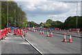
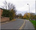
10
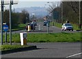
Looking northwest along Anstey Lane
Bradgate Park is the high ground in the distance.
Image: © Mat Fascione
Taken: 1 Apr 2007
0.11 miles