IMAGES TAKEN NEAR TO
Lomond Crescent, LEICESTER, LE4 0RL
Introduction
This page details the photographs taken nearby to Lomond Crescent, LE4 0RL by members of the Geograph project.
The Geograph project started in 2005 with the aim of publishing, organising and preserving representative images for every square kilometre of Great Britain, Ireland and the Isle of Man.

There are currently over 7.5m images from over14,400 individuals and you can help contribute to the project by visiting https://www.geograph.org.uk
Image Map
Images are licensed for reuse under creativecommons.org/licenses/by-sa/2.0
Notes
- Clicking on the map will re-center to the selected point.
- The higher the marker number, the further away the image location is from the centre of the postcode.
Image Listing (12 Images Found)
Images are licensed for reuse under creativecommons.org/licenses/by-sa/2.0
Image
Details
Distance
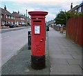
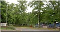
3
Cheltenham Road
Showing pillar box LE4 737!
Image: © Andrew Tatlow
Taken: 3 May 2013
0.13 miles
7
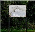
Beaumont Leys Phase One sign
One wonders what happened to Phase Two. Phase One must have been a complete blank.
Image: © Andrew Tatlow
Taken: 3 May 2013
0.23 miles