IMAGES TAKEN NEAR TO
Green Walk, LEICESTER, LE3 6SE
Introduction
This page details the photographs taken nearby to Green Walk, LE3 6SE by members of the Geograph project.
The Geograph project started in 2005 with the aim of publishing, organising and preserving representative images for every square kilometre of Great Britain, Ireland and the Isle of Man.

There are currently over 7.5m images from over14,400 individuals and you can help contribute to the project by visiting https://www.geograph.org.uk
Image Map
Images are licensed for reuse under creativecommons.org/licenses/by-sa/2.0
Notes
- Clicking on the map will re-center to the selected point.
- The higher the marker number, the further away the image location is from the centre of the postcode.
Image Listing (18 Images Found)
Images are licensed for reuse under creativecommons.org/licenses/by-sa/2.0
Image
Details
Distance
1
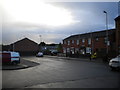
Park Rise bus terminus, Leicester
This large and rather rectangular turning facility doubles as a small car park for the shops out of frame to the right. At the time of this visit it was served by route 12 from Leicester city centre via Glenfield Road.
Image: © Richard Vince
Taken: 13 Oct 2012
0.06 miles
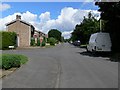
2
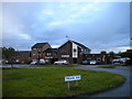
The Sportsman, Park Rise
Hailing as I do from Wolverhampton, I always find it strange to see a Banks's sign outside a pub anywhere other than in the West Midlands. This example is on a postwar housing estate in Leicester.
Image: © Richard Vince
Taken: 13 Oct 2012
0.07 miles
4
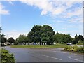
Scudamore Road Roundabout, Braunstone Frith, Leicester
Image: © Tim Heaton
Taken: 1 Jun 2022
0.13 miles
5
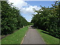
Park View at Western Park, Leicester
The trees are along the south-western edge of the park.
Image: © Mat Fascione
Taken: 23 Oct 2016
0.14 miles
7
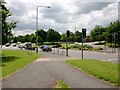
Scudamore Road roundabout on A563 New Parks Way
Part of the Leicester ring road.
Image: © David P Howard
Taken: 15 Jun 2010
0.15 miles
8
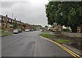
Park View, Leicester
This residential road runs along the western edge of Western Park, The Meads forms the road junction.
Image: © Mat Fascione
Taken: 7 Jul 2007
0.17 miles
9
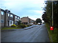
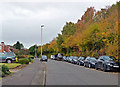
Park View, Leicester
The southern end of Park View, a residential road that parallels the western edge of Western Park.
Image: © Richard Vince
Taken: 13 Oct 2012
0.17 miles
10

Mobile Phone Mast
Located just off Park View on the western edge of Western Park.
Image: © Mat Fascione
Taken: 7 Jul 2007
0.18 miles