IMAGES TAKEN NEAR TO
Mann Close, LEICESTER, LE3 3RH
Introduction
This page details the photographs taken nearby to Mann Close, LE3 3RH by members of the Geograph project.
The Geograph project started in 2005 with the aim of publishing, organising and preserving representative images for every square kilometre of Great Britain, Ireland and the Isle of Man.

There are currently over 7.5m images from over14,400 individuals and you can help contribute to the project by visiting https://www.geograph.org.uk
Image Map
Images are licensed for reuse under creativecommons.org/licenses/by-sa/2.0
Notes
- Clicking on the map will re-center to the selected point.
- The higher the marker number, the further away the image location is from the centre of the postcode.
Image Listing (46 Images Found)
Images are licensed for reuse under creativecommons.org/licenses/by-sa/2.0
Image
Details
Distance
3
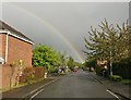
Rainbow over Cobbett Road in Thorpe Astley
Image: © Mat Fascione
Taken: 26 Apr 2017
0.04 miles
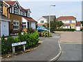
4
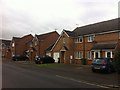
Darien Way
2000s houses in Braunstone.
Image: © Burgess Von Thunen
Taken: 6 Dec 2013
0.07 miles
5
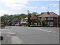
Westover Road - Hardie Crescent Crossroads
Image: © Peter Whatley
Taken: 7 May 2009
0.13 miles
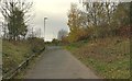
6
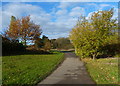
Path at Thorpe Astley
The path is heading towards Collins Close and Foxholes Spinney.
Image: © Mat Fascione
Taken: 22 Nov 2013
0.13 miles
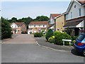
7
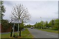
Withers Way entering Thorpe Astley
A newer part of Braunstone Town, built on its last area of agricultural land in the late 1990s.
Image: © Tim Heaton
Taken: 5 May 2021
0.13 miles
8
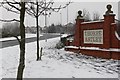
Withers Way in Thorpe Astley, Leicester
During some heavy snow in early February 2009.
Image: © Mat Fascione
Taken: 2 Feb 2009
0.15 miles
9
Path next to the A563 Lubbesthorpe Way
Image: © Mat Fascione
Taken: 13 Nov 2017
0.15 miles