IMAGES TAKEN NEAR TO
Juniper Close, LEICESTER, LE3 3JX
Introduction
This page details the photographs taken nearby to Juniper Close, LE3 3JX by members of the Geograph project.
The Geograph project started in 2005 with the aim of publishing, organising and preserving representative images for every square kilometre of Great Britain, Ireland and the Isle of Man.

There are currently over 7.5m images from over14,400 individuals and you can help contribute to the project by visiting https://www.geograph.org.uk
Image Map
Images are licensed for reuse under creativecommons.org/licenses/by-sa/2.0
Notes
- Clicking on the map will re-center to the selected point.
- The higher the marker number, the further away the image location is from the centre of the postcode.
Image Listing (16 Images Found)
Images are licensed for reuse under creativecommons.org/licenses/by-sa/2.0
Image
Details
Distance
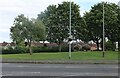
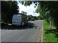
2
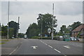
Forest House Lane at Leicester Forest East
Image: © Mat Fascione
Taken: 10 Nov 2017
0.16 miles
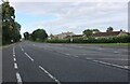
3
Forest House Lane at Leicester Forest East
Image: © Mat Fascione
Taken: 8 Feb 2017
0.16 miles
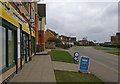
4
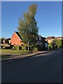
Green on Hinckley Road, Leicester Forest East
Image: © David Howard
Taken: 2 Jul 2023
0.16 miles
5
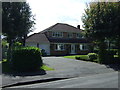
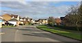
House on Brickman Close, Leicester Forest East
Image: © JThomas
Taken: 4 Aug 2012
0.16 miles
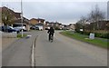
9
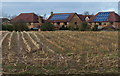
Houses on Forest House Lane
The houses and farmland are on the edge of Leicester Forest East, on the western edge of Leicester city.
Image: © Mat Fascione
Taken: 19 Jan 2014
0.18 miles