IMAGES TAKEN NEAR TO
Evelyn Road, LEICESTER, LE3 3BA
Introduction
This page details the photographs taken nearby to Evelyn Road, LE3 3BA by members of the Geograph project.
The Geograph project started in 2005 with the aim of publishing, organising and preserving representative images for every square kilometre of Great Britain, Ireland and the Isle of Man.

There are currently over 7.5m images from over14,400 individuals and you can help contribute to the project by visiting https://www.geograph.org.uk
Image Map (Loading...)


Getting Data...Please wait
Leaflet Map data © OpenStreetMap
Images are licensed for reuse under creativecommons.org/licenses/by-sa/2.0
Notes
- Clicking on the map will re-center to the selected point.
- The higher the marker number, the further away the image location is from the centre of the postcode.
Image Listing (95 Images Found)
Images are licensed for reuse under creativecommons.org/licenses/by-sa/2.0
Image
Details
Distance
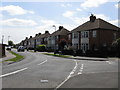
2
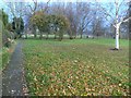
Leicester, LE3 - Old Braunstone
Cressida Place consists of a row of terraced cottages facing a communal grassed area that separates the houses from Main Street. The properties were commissioned by the Winstanley family, owners of Braunstone Hall and the Braunstone Park Estate, as estate workers' cottages and were designed by William Butterfield in 1859. The footpath in front of the houses connects Main Street with one of the entrances into Church Field, a protected one-hectare meadow occupying the space between St Peter’s Church and Main Street.
Image: © David Hallam-Jones
Taken: 1 Jul 2012
0.07 miles
4
Houses of Cressida Place (off Braunstone Lane)
There is an OS benchmark Image on the right hand corner of the house
Image: © Luke Shaw
Taken: 11 Sep 2018
0.07 miles
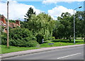
5
Kingsway North in Braunstone
At the junction with Neal Avenue.
Image: © Mat Fascione
Taken: 22 Nov 2013
0.07 miles
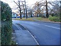
6
Woodland on northeast side of Braunstone Lane
Ordnance Survey documents indicate that in 1964 there was a rivet benchmark levelled at 86.082m above Newlyn Datum on a rock near the side of the road. A candidate rock was found but there was no sign of a rivet.
Image: © phil Richards
Taken: 11 Sep 2018
0.07 miles
8
Trees at Cressida Place in Braunstone
With a row of former estate workers’ cottages, built in 1859.
Image: © Mat Fascione
Taken: 29 Dec 2016
0.08 miles
9
Cressida Place in Braunstone
This is a conservation area in the heart of old Braunstone village.
Image: © Mat Fascione
Taken: 26 Nov 2008
0.08 miles
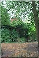
10

Partly hidden benchmark on No. 1 Cressida Place
Ordnance Survey cut mark benchmark described on the Bench Mark Database at www.bench-marks.org.uk/bm99541
Image: © phil Richards
Taken: 11 Sep 2018
0.08 miles