IMAGES TAKEN NEAR TO
Beaconsfield Road, LEICESTER, LE3 0FF
Introduction
This page details the photographs taken nearby to Beaconsfield Road, LE3 0FF by members of the Geograph project.
The Geograph project started in 2005 with the aim of publishing, organising and preserving representative images for every square kilometre of Great Britain, Ireland and the Isle of Man.

There are currently over 7.5m images from over14,400 individuals and you can help contribute to the project by visiting https://www.geograph.org.uk
Image Map
Images are licensed for reuse under creativecommons.org/licenses/by-sa/2.0
Notes
- Clicking on the map will re-center to the selected point.
- The higher the marker number, the further away the image location is from the centre of the postcode.
Image Listing (48 Images Found)
Images are licensed for reuse under creativecommons.org/licenses/by-sa/2.0
Image
Details
Distance
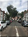
1
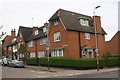
#171 Upperton Road at Sykefield Avenue junction
There is an OS benchmark Image on the near corner, right hand face, of the nearest house
Image: © Roger Templeman
Taken: 11 May 2018
0.06 miles
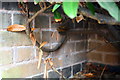
2
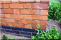
Benchmark on #171 Upperton Road (Sykefield Avenue face)
Ordnance Survey cut mark benchmark described on the Bench Mark Database at https://www.bench-marks.org.uk/bm102481
Image: © Roger Templeman
Taken: 11 May 2018
0.06 miles
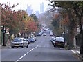
3
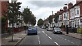
Barclay St, Leicester
Close to the junction with Fosse Road South
Image: © John Welford
Taken: 9 Sep 2015
0.06 miles
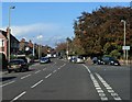
4
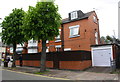
Upperton Road face of #192 Fosse Road South
There is an OS benchmark on the right hand side of the garage just past the gate. A photo showing the mark is not considered suitable for Geograph but is available from the contributor.
Image: © Roger Templeman
Taken: 11 May 2018
0.08 miles
5
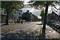
Fosse Road South in Westcotes, Leicester
Image: © Mat Fascione
Taken: 5 Oct 2017
0.09 miles

10
Benchmark on hospital lodge, Westcotes Drive
Ordnance Survey cut mark benchmark described on the Bench Mark Database at https://www.bench-marks.org.uk/bm102478
Image: © Roger Templeman
Taken: 11 May 2018
0.15 miles