IMAGES TAKEN NEAR TO
Navigation Drive, LEICESTER, LE2 9TB

Introduction

This page details the photographs taken nearby to Navigation Drive, LE2 9TB by members of the Geograph project.

The Geograph project started in 2005 with the aim of publishing, organising and preserving representative images for every square kilometre of Great Britain, Ireland and the Isle of Man.

There are currently over 7.5m images from over14,400 individuals and you can help contribute to the project by visiting https://www.geograph.org.uk

Image Map


Images are licensed for reuse under creativecommons.org/licenses/by-sa/2.0
Notes
  • Clicking on the map will re-center to the selected point.
  • The higher the marker number, the further away the image location is from the centre of the postcode.

Image Listing (57 Images Found)

Images are licensed for reuse under creativecommons.org/licenses/by-sa/2.0
  • ...
Image
Details
Distance
1
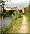
Navigation Drive in Glen Parva, Leicester
Viewed from Navigation Drive Bridge No 99A, crossing the Grand Union Canal.
Image: © Mat Fascione Taken: 31 Jul 2019
0.02 miles
2
Bridge 99a
Grand Union Canal Leicester Section
Image: © Mike Todd Taken: 21 Mar 2011
0.03 miles
3
Sunset over the Grand Union Canal
The houses are on New Bridge Road in Glen Parva.
Image: © Mat Fascione Taken: 6 Feb 2023
0.05 miles
4
Bridge 99A
Carrying Navigation Road over the Grand Union Canal.
Image: © Andrew Abbott Taken: 31 Aug 2020
0.05 miles
5
Navigation Drive Bridge
Crossing the Grand Union Canal in Glen Parva, Leicester.
Image: © Mat Fascione Taken: 29 Jun 2007
0.05 miles
6
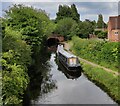
Narrowboats moored along the Grand Union Canal
The boats are moored between bridges 99 and 99A in Glen Parva.
Image: © Mat Fascione Taken: 29 Jun 2022
0.05 miles
7
River Sence, Glen Parva near Leicester
Looking upstream from the foot bridge on National Cycleway 6. The river was once called the Glene: from the Celtic word glano, meaning 'clean' or 'holy'. The name Sence first appears on early maps around 1600. The river rises from two springs near Billesdon (Image), about 18 miles away to the east, and it drops about 170 metres to the ford in http://www.geograph.org.uk/photo/125064. It joins the River Soar at Jubilee Park in Image The fields beside the river are prone to flooding.
Image: © Kate Jewell Taken: 2 Jun 2006
0.05 miles
8
Grand Union Canal in Glen Parva
This stretch of the canal is between bridges 99A and 99.
Image: © Mat Fascione Taken: 31 Jul 2019
0.05 miles
9
Grand Union Canal [Leicester section] at Glen Parva
Looking westwards. The houses behind the hedge are in Navigation Drive.
Image: © Christine Johnstone Taken: 4 May 2019
0.06 miles
10
Grand Union Canal in Glen Parva
Viewed from Whetstone Lane Bridge No 99. The houses on the left are along New Bridge Road.
Image: © Mat Fascione Taken: 1 May 2020
0.06 miles
  • ...