IMAGES TAKEN NEAR TO
Bushey Close, LEICESTER, LE19 3FP
Introduction
This page details the photographs taken nearby to Bushey Close, LE19 3FP by members of the Geograph project.
The Geograph project started in 2005 with the aim of publishing, organising and preserving representative images for every square kilometre of Great Britain, Ireland and the Isle of Man.

There are currently over 7.5m images from over14,400 individuals and you can help contribute to the project by visiting https://www.geograph.org.uk
Image Map (Loading...)


Getting Data...Please wait
Leaflet Map data © OpenStreetMap
Images are licensed for reuse under creativecommons.org/licenses/by-sa/2.0
Notes
- Clicking on the map will re-center to the selected point.
- The higher the marker number, the further away the image location is from the centre of the postcode.
Image Listing (9 Images Found)
Images are licensed for reuse under creativecommons.org/licenses/by-sa/2.0
Image
Details
Distance
2
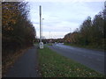
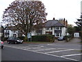
King Edward Avenue (B4114), Narborough
Looking north east.
Image: © JThomas
Taken: 19 Nov 2016
0.18 miles
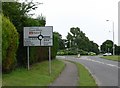
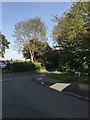
4
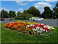
Roundabout on the B4114
The flowers are on the corner of Desford Road.
Image: © Mat Fascione
Taken: 7 Sep 2014
0.18 miles
5
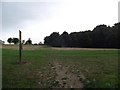
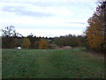
Footpath through Carlton Park
Once part of the grounds of Carlton Hayes Hospital
Image: © Tim Glover
Taken: 24 Jul 2016
0.19 miles
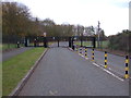
8
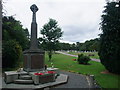
Memorial to The Glorious Dead, Narborough Cemetery
Image: © Tim Heaton
Taken: 23 Jul 2011
0.23 miles