IMAGES TAKEN NEAR TO
Tansley Avenue, WIGSTON, LE18 4ND
Introduction
This page details the photographs taken nearby to Tansley Avenue, LE18 4ND by members of the Geograph project.
The Geograph project started in 2005 with the aim of publishing, organising and preserving representative images for every square kilometre of Great Britain, Ireland and the Isle of Man.

There are currently over 7.5m images from over14,400 individuals and you can help contribute to the project by visiting https://www.geograph.org.uk
Image Map
Images are licensed for reuse under creativecommons.org/licenses/by-sa/2.0
Notes
- Clicking on the map will re-center to the selected point.
- The higher the marker number, the further away the image location is from the centre of the postcode.
Image Listing (37 Images Found)
Images are licensed for reuse under creativecommons.org/licenses/by-sa/2.0
Image
Details
Distance
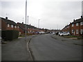
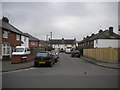
1
Tansley Avenue, South Wigston
Off Lansdowne Grove.
Image: © Richard Vince
Taken: 11 Mar 2017
0.02 miles
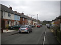
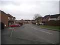
3
Lansdowne Grove, South Wigston
Heading north towards the B582.
Image: © JThomas
Taken: 29 Mar 2014
0.09 miles
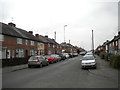
4
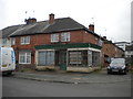
Closed shop, Lansdowne Grove, South Wigston
Shadows of the words "SR GROCERS OFF LICENCE CONVENIENCE STORE" can be made out on what was the shop sign. The Pepsi branded fridge visible in the window gives an idea of how long ago the shop may have closed: that style of branding was replaced in 1991.
Image: © Richard Vince
Taken: 11 Mar 2017
0.11 miles
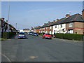
5
Denacre Avenue, South Wigston
Off Lansdowne Grove.
Image: © Richard Vince
Taken: 11 Mar 2017
0.11 miles
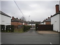
6
Chatsworth Avenue, South Wigston
Off Lansdowne Grove, with the Wigston campus of South Leicestershire College looming in the background.
Image: © Richard Vince
Taken: 11 Mar 2017
0.12 miles
8
Florence Avenue, South Wigston
Off Lansdowne Grove.
Image: © Richard Vince
Taken: 11 Mar 2017
0.14 miles
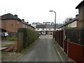
9
Ervin's Lock, South Wigston
This road is named after the nearby lock on the Leicester branch of the Grand Union Canal, but confusingly does not have a suffix ("Road" or similar).
Image: © Richard Vince
Taken: 11 Mar 2017
0.14 miles