IMAGES TAKEN NEAR TO
Wistow Road, WIGSTON, LE18 3SQ
Introduction
This page details the photographs taken nearby to Wistow Road, LE18 3SQ by members of the Geograph project.
The Geograph project started in 2005 with the aim of publishing, organising and preserving representative images for every square kilometre of Great Britain, Ireland and the Isle of Man.

There are currently over 7.5m images from over14,400 individuals and you can help contribute to the project by visiting https://www.geograph.org.uk
Image Map
Images are licensed for reuse under creativecommons.org/licenses/by-sa/2.0
Notes
- Clicking on the map will re-center to the selected point.
- The higher the marker number, the further away the image location is from the centre of the postcode.
Image Listing (35 Images Found)
Images are licensed for reuse under creativecommons.org/licenses/by-sa/2.0
Image
Details
Distance
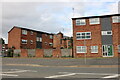
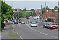
5
Welford Road, Wigston
At the junction of Newton Lane
Image: © David Howard
Taken: 5 Jun 2022
0.10 miles
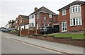
6
Welford Road towards Moat Street junction
Image: © Mat Fascione
Taken: 24 May 2008
0.11 miles
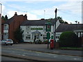
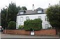
7
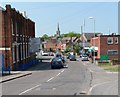
Newton Lane, Wigston
Looking towards its junction with Bull Head Street, Moat Street and Welford Road. All Saints Church is visible in the centre of the picture.
Image: © Mat Fascione
Taken: 28 Apr 2007
0.11 miles