IMAGES TAKEN NEAR TO
Portgate, WIGSTON, LE18 3LQ
Introduction
This page details the photographs taken nearby to Portgate, LE18 3LQ by members of the Geograph project.
The Geograph project started in 2005 with the aim of publishing, organising and preserving representative images for every square kilometre of Great Britain, Ireland and the Isle of Man.

There are currently over 7.5m images from over14,400 individuals and you can help contribute to the project by visiting https://www.geograph.org.uk
Image Map
Images are licensed for reuse under creativecommons.org/licenses/by-sa/2.0
Notes
- Clicking on the map will re-center to the selected point.
- The higher the marker number, the further away the image location is from the centre of the postcode.
Image Listing (28 Images Found)
Images are licensed for reuse under creativecommons.org/licenses/by-sa/2.0
Image
Details
Distance
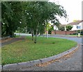
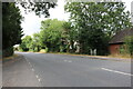
3
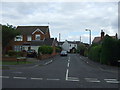
Cottage Road, Wigston
East of Welford Road (A5199).
Image: © JThomas
Taken: 9 Aug 2014
0.14 miles
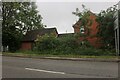
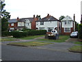
5
Cottage Road, Wigston Magna
A residential cul de sac off Welford Road.
Image: © Richard Vince
Taken: 11 Mar 2017
0.16 miles
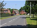
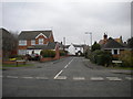
6
Houses by Welford Road, Wigston
The fronts are on Broughton Field.
Image: © David Howard
Taken: 2 Aug 2022
0.17 miles
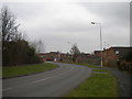
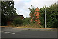
8
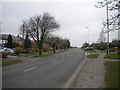
Welford Road, Wigston Magna
Looking towards Wigston town centre and Leicester.
Image: © Richard Vince
Taken: 11 Mar 2017
0.17 miles