IMAGES TAKEN NEAR TO
Hothorpe, LUTTERWORTH, LE17 6QX
Introduction
This page details the photographs taken nearby to Hothorpe, LE17 6QX by members of the Geograph project.
The Geograph project started in 2005 with the aim of publishing, organising and preserving representative images for every square kilometre of Great Britain, Ireland and the Isle of Man.

There are currently over 7.5m images from over14,400 individuals and you can help contribute to the project by visiting https://www.geograph.org.uk
Image Map
Images are licensed for reuse under creativecommons.org/licenses/by-sa/2.0
Notes
- Clicking on the map will re-center to the selected point.
- The higher the marker number, the further away the image location is from the centre of the postcode.
Image Listing (14 Images Found)
Images are licensed for reuse under creativecommons.org/licenses/by-sa/2.0
Image
Details
Distance
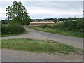
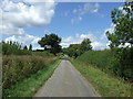
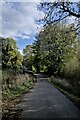
2
Thedingworth Road
Heading north east towards Marston Trussell.
Image: © JThomas
Taken: 9 Aug 2014
0.09 miles
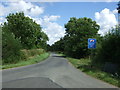
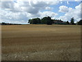
4
Lane junction
Straight on for Sibbertoft, left for Marston Trussell.
Image: © Mat Fascione
Taken: 2 Sep 2007
0.15 miles
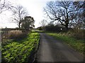
5
Hothorpe Road
Minor road heading north west towards Theddingworth.
Image: © JThomas
Taken: 9 Aug 2014
0.17 miles
6
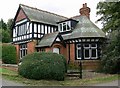
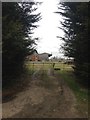
Entrance to Hothorpe Hall
http://www.hothorpe.co.uk/
Image: © Mat Fascione
Taken: 2 Sep 2007
0.17 miles
8
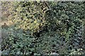
Somewhere in there
We are looking downstream from the bridge over the River Welland, whose waters are somewhere in among this tangle of vegetation.
Image: © Bob Harvey
Taken: 28 Oct 2022
0.20 miles
9
There is a bridge
The lowest part of this road is a bridge over the River Welland. It is just past the largest Ash tree on the right.
Image: © Bob Harvey
Taken: 28 Oct 2022
0.20 miles
10

Bridge construction
The parapet and arch of a brick bridge, and very slightly upstream a pair of profiled concrete pillars. These might have been for stop boards to hold the river back during bridge works, but I think they are probably the remains of a former pipe bridge.
Image: © Bob Harvey
Taken: 28 Oct 2022
0.20 miles