IMAGES TAKEN NEAR TO
Kilworth Road, LUTTERWORTH, LE17 6BQ
Introduction
This page details the photographs taken nearby to Kilworth Road, LE17 6BQ by members of the Geograph project.
The Geograph project started in 2005 with the aim of publishing, organising and preserving representative images for every square kilometre of Great Britain, Ireland and the Isle of Man.

There are currently over 7.5m images from over14,400 individuals and you can help contribute to the project by visiting https://www.geograph.org.uk
Image Map
Images are licensed for reuse under creativecommons.org/licenses/by-sa/2.0
Notes
- Clicking on the map will re-center to the selected point.
- The higher the marker number, the further away the image location is from the centre of the postcode.
Image Listing (69 Images Found)
Images are licensed for reuse under creativecommons.org/licenses/by-sa/2.0
Image
Details
Distance
3
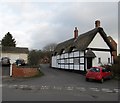
Swinford-School Lane
Thatched Cottage on the lane to the school.
Image: © Ian Rob
Taken: 8 Jan 2012
0.10 miles
5
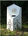
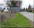
Milepost
Along Kibworth Road on the north eastern edge of the Leicestershire village of Swinford.
Image: © Mat Fascione
Taken: 20 Oct 2007
0.11 miles
6
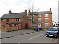
Swinford-North Street
Houses and Telephone Box.
Image: © Ian Rob
Taken: 8 Jan 2012
0.11 miles
8
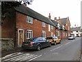
Swinford-High Street
Houses next to the church.
Image: © Ian Rob
Taken: 8 Jan 2012
0.12 miles
9
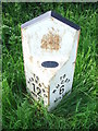
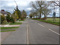
Old Milepost
Old milepost near to Swinford, Leicestershire. For overall view see http://www.geograph.org.uk/photo/2999018
Image: © Keith Evans
Taken: 21 May 2012
0.12 miles
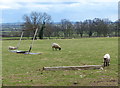
10
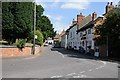
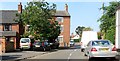
The village of Swinford
Cottages and the Chequers Inn opposite Swinford church.
Image: © Philip Halling
Taken: 8 Aug 2015
0.13 miles