IMAGES TAKEN NEAR TO
Ashby Lane, LUTTERWORTH, LE17 4LW
Introduction
This page details the photographs taken nearby to Ashby Lane, LE17 4LW by members of the Geograph project.
The Geograph project started in 2005 with the aim of publishing, organising and preserving representative images for every square kilometre of Great Britain, Ireland and the Isle of Man.

There are currently over 7.5m images from over14,400 individuals and you can help contribute to the project by visiting https://www.geograph.org.uk
Image Map
Images are licensed for reuse under creativecommons.org/licenses/by-sa/2.0
Notes
- Clicking on the map will re-center to the selected point.
- The higher the marker number, the further away the image location is from the centre of the postcode.
Image Listing (9 Images Found)
Images are licensed for reuse under creativecommons.org/licenses/by-sa/2.0
Image
Details
Distance
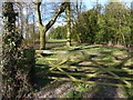
3
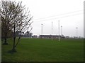
Lutterworth
Lutterworth Rugby Football Club on the road to Ashby Parva.
Image: © Ian Rob
Taken: 21 Apr 2006
0.15 miles
6
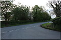
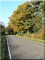
Ashby Lane at the junction of Cauldwell Lane
Image: © David Howard
Taken: 16 May 2021
0.19 miles
7
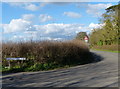
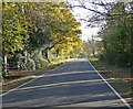
Cauldwell Lane and Ashby Lane junction
Image: © Mat Fascione
Taken: 18 Apr 2013
0.19 miles
8
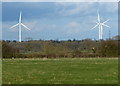
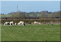
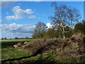
View towards Low Spinney Wind Farm
The field in the foreground is along Ashby Lane.
Image: © Mat Fascione
Taken: 18 Apr 2013
0.25 miles