IMAGES TAKEN NEAR TO
Valley Close, LUTTERWORTH, LE17 4FQ
Introduction
This page details the photographs taken nearby to Valley Close, LE17 4FQ by members of the Geograph project.
The Geograph project started in 2005 with the aim of publishing, organising and preserving representative images for every square kilometre of Great Britain, Ireland and the Isle of Man.

There are currently over 7.5m images from over14,400 individuals and you can help contribute to the project by visiting https://www.geograph.org.uk
Image Map
Images are licensed for reuse under creativecommons.org/licenses/by-sa/2.0
Notes
- Clicking on the map will re-center to the selected point.
- The higher the marker number, the further away the image location is from the centre of the postcode.
Image Listing (10 Images Found)
Images are licensed for reuse under creativecommons.org/licenses/by-sa/2.0
Image
Details
Distance
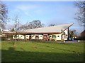
2
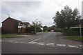
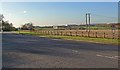
The western edge of Lutterworth
Coventry Road marks the western boundary of Lutterworth in this recently built part of the Leicestershire town.
Image: © Mat Fascione
Taken: 23 Nov 2007
0.05 miles
4
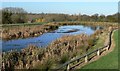
Lutterworth Country Park
This small lake forms part of this Country Park on the western edge of Lutterworth in Leicestershire.
Image: © Mat Fascione
Taken: 23 Nov 2007
0.17 miles
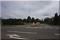
5
Coventry Road in Lutterworth
Magna Park is visible in the background.
Image: © Mat Fascione
Taken: 23 Nov 2007
0.18 miles
6
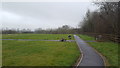
First graves in the new cemetery
The new graveyard on the outskirts of Lutterworth with the first few deceased persons.
Image: © Peter Mackenzie
Taken: 19 Feb 2018
0.20 miles
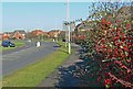
7
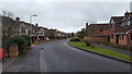
Housing in Cunningham Drive
Part of a housing development on the western edge of Lutterworth.
Image: © Peter Mackenzie
Taken: 13 Feb 2018
0.21 miles
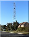
8
Lutterworth
Red Arrow Public House on Coventry Rd
Image: © Ian Rob
Taken: 31 Dec 2005
0.23 miles
9
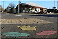
Stop Look Listen
The Red Arrow public house at the junction of Coventry Road and Woodway Road in Lutterworth, Leicestershire.
Image: © Mat Fascione
Taken: 23 Nov 2007
0.23 miles