IMAGES TAKEN NEAR TO
Sovereign Park Industrial Estate, MARKET HARBOROUGH, LE16 9EG
Introduction
This page details the photographs taken nearby to Sovereign Park Industrial Estate, LE16 9EG by members of the Geograph project.
The Geograph project started in 2005 with the aim of publishing, organising and preserving representative images for every square kilometre of Great Britain, Ireland and the Isle of Man.

There are currently over 7.5m images from over14,400 individuals and you can help contribute to the project by visiting https://www.geograph.org.uk
Image Map
Images are licensed for reuse under creativecommons.org/licenses/by-sa/2.0
Notes
- Clicking on the map will re-center to the selected point.
- The higher the marker number, the further away the image location is from the centre of the postcode.
Image Listing (51 Images Found)
Images are licensed for reuse under creativecommons.org/licenses/by-sa/2.0
Image
Details
Distance
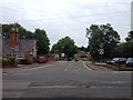
1

Entrance to the allotments on Northampton Road, Market Harborough
Image: © David Howard
Taken: 2 Jul 2019
0.07 miles

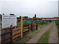


9

The Parish Cemetery
The cemetery for the church of St. Dionysius, on Northampton Road in Market Harborough. The chapel was built in 1877.
Image: © Mat Fascione
Taken: 8 Oct 2007
0.09 miles