IMAGES TAKEN NEAR TO
East Norton Road, MARKET HARBOROUGH, LE16 8UP
Introduction
This page details the photographs taken nearby to East Norton Road, LE16 8UP by members of the Geograph project.
The Geograph project started in 2005 with the aim of publishing, organising and preserving representative images for every square kilometre of Great Britain, Ireland and the Isle of Man.

There are currently over 7.5m images from over14,400 individuals and you can help contribute to the project by visiting https://www.geograph.org.uk
Image Map
Images are licensed for reuse under creativecommons.org/licenses/by-sa/2.0
Notes
- Clicking on the map will re-center to the selected point.
- The higher the marker number, the further away the image location is from the centre of the postcode.
Image Listing (57 Images Found)
Images are licensed for reuse under creativecommons.org/licenses/by-sa/2.0
Image
Details
Distance
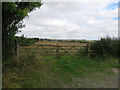
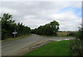
2
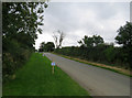
East Norton Road towards Hallaton
The square boundary follows the hedge to the right.
Image: © Andrew Tatlow
Taken: 12 Sep 2016
0.02 miles
5
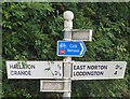
Signpost at East Norton Road/Allexton Road junction
See Image
Image: © Andrew Tatlow
Taken: 12 Sep 2016
0.06 miles
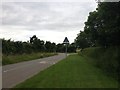
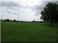
6
East Norton Road/Allexton Road junction
See Image
Image: © Andrew Tatlow
Taken: 12 Sep 2016
0.06 miles
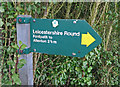
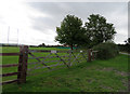
7
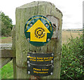
Footpath signs on gatepost
The Leicestershire Round is clearly marked. See Image
Image: © Andrew Tatlow
Taken: 12 Sep 2016
0.06 miles