IMAGES TAKEN NEAR TO
The Old Stables, MARKET HARBOROUGH, LE16 7SB
Introduction
This page details the photographs taken nearby to The Old Stables, LE16 7SB by members of the Geograph project.
The Geograph project started in 2005 with the aim of publishing, organising and preserving representative images for every square kilometre of Great Britain, Ireland and the Isle of Man.

There are currently over 7.5m images from over14,400 individuals and you can help contribute to the project by visiting https://www.geograph.org.uk
Image Map
Images are licensed for reuse under creativecommons.org/licenses/by-sa/2.0
Notes
- Clicking on the map will re-center to the selected point.
- The higher the marker number, the further away the image location is from the centre of the postcode.
Image Listing (19 Images Found)
Images are licensed for reuse under creativecommons.org/licenses/by-sa/2.0
Image
Details
Distance
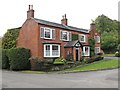
4
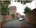
East Langton, Leicestershire
The large castellated water tower belongs to East Langton Grange.
Image: © Mat Fascione
Taken: 14 Oct 2007
0.04 miles
6
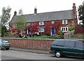
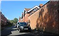
The Bell at East Langton
A public house on Main Street in the Leicestershire village of East Langton.
Image: © Mat Fascione
Taken: 14 Oct 2007
0.06 miles
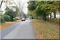
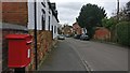
10
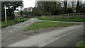
Road junction and grass triangle
Minor road and junction near East Langton
Image: © Michael Trolove
Taken: 28 Mar 2016
0.13 miles