IMAGES TAKEN NEAR TO
Centenary Close, MARKET HARBOROUGH, LE16 7NW
Introduction
This page details the photographs taken nearby to Centenary Close, LE16 7NW by members of the Geograph project.
The Geograph project started in 2005 with the aim of publishing, organising and preserving representative images for every square kilometre of Great Britain, Ireland and the Isle of Man.

There are currently over 7.5m images from over14,400 individuals and you can help contribute to the project by visiting https://www.geograph.org.uk
Image Map
Images are licensed for reuse under creativecommons.org/licenses/by-sa/2.0
Notes
- Clicking on the map will re-center to the selected point.
- The higher the marker number, the further away the image location is from the centre of the postcode.
Image Listing (10 Images Found)
Images are licensed for reuse under creativecommons.org/licenses/by-sa/2.0
Image
Details
Distance
1
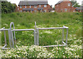
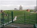
Balancing Pond for new development
This shows a balancing pond constructed as part of a SuDS (Sustainable Urban Drainage System) for Centenary Close (the houses in the background), Market Harborough. The idea is that the depressed area of the balancing pond (or retention basin) allows compensation of surface runoff from the area of development lost to hard surfaces.
Image: © SK53
Taken: 18 Jun 2016
0.05 miles
2
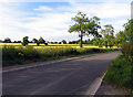
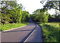
Burnmill Road towards Market Harborough
Image: © Andrew Tatlow
Taken: 9 Jul 2014
0.16 miles
3
Burnmill Road towards Market Harborough
Image: © Andrew Tatlow
Taken: 4 Jun 2015
0.16 miles
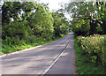
4
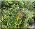
Thistles by the roadside
An impressive bank of thistles was thriving by the roadside.
Image: © Andrew Tatlow
Taken: 9 Jul 2014
0.18 miles
5
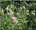
Thistles in flower by the roadside
An impressive bank of thistles was thriving by the roadside.
Image: © Andrew Tatlow
Taken: 9 Jul 2014
0.18 miles

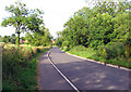
7
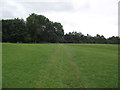
Footpath from Great Bowden to Market Harborough
Image: © Tim Glover
Taken: 16 Jun 2018
0.22 miles
8
Protected water supply.
Heavily barbwired water reservoir on high ground above Great Bowden.
Image: © Richard Williams
Taken: 29 Jan 2007
0.22 miles