IMAGES TAKEN NEAR TO
Wheatley Avenue, OAKHAM, LE15 9SN
Introduction
This page details the photographs taken nearby to Wheatley Avenue, LE15 9SN by members of the Geograph project.
The Geograph project started in 2005 with the aim of publishing, organising and preserving representative images for every square kilometre of Great Britain, Ireland and the Isle of Man.

There are currently over 7.5m images from over14,400 individuals and you can help contribute to the project by visiting https://www.geograph.org.uk
Image Map (Loading...)


Getting Data...Please wait
Leaflet Map data © OpenStreetMap
Images are licensed for reuse under creativecommons.org/licenses/by-sa/2.0
Notes
- Clicking on the map will re-center to the selected point.
- The higher the marker number, the further away the image location is from the centre of the postcode.
Image Listing (92 Images Found)
Images are licensed for reuse under creativecommons.org/licenses/by-sa/2.0
Image
Details
Distance
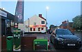
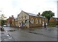
2
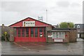
Uppingham fire station
Uppingham fire station, Ayston Road, Uppingham, Leicestershire
Image: © Kevin Hale
Taken: 5 Dec 2007
0.10 miles
3
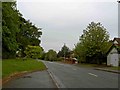
A6003 Ayston Road, Uppingham
Towards the town centre.
Image: © Robin Webster
Taken: 18 Jul 2021
0.14 miles
4
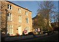
Houses on Ayston Road, Uppingham
Cornices and mullioned windows on these stone houses on the west side of Ayston Road.
Image: © Derek Harper
Taken: 11 Dec 2007
0.16 miles
6
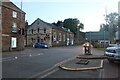
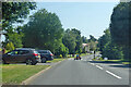
North Street East, Uppingham
At the junction of Ayston Road
Image: © David Howard
Taken: 8 May 2022
0.18 miles
7
![Uppingham houses [19]](https://s2.geograph.org.uk/geophotos/07/14/56/7145610_9d17edfb_120x120.jpg)
Uppingham houses [19]
The Old Cottage, number 2 Hope's Yard, was originally two cottages. Built in the 17th century of coursed rubble stone under a tile roof. Listed, grade II, with details at: https://historicengland.org.uk/listing/the-list/list-entry/1361446
Uppingham is a market town in the county of Rutland, and received its charter in 1281. It is located near the border with Northamptonshire, approximately 17 miles east of Leicester and some 20 miles west of Peterborough. The A47 road ran through the town until a bypass was built in 1982. The town is home to Uppingham School, an independent, co-educational, fee charging school for boarders aged 13 to 18, founded in 1584.
Image: © Michael Dibb
Taken: 28 Sep 2021
0.19 miles
8
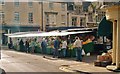
Uppingham: Market Place
Market Day
Image: © Mr Eugene Birchall
Taken: 12 Jul 2002
0.19 miles
9
3 storey house in Uppingham
Seen on North street West.
Image: © Michael Trolove
Taken: 7 Apr 2013
0.19 miles
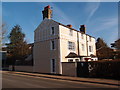
10
Uppingham Methodist Church
At the corner of Orange Street and North Street West; dated 1819: http://stamfordrutlandmethodists.org.uk/History%20of%20Uppingham.htm
Image: © Mike Faherty
Taken: 11 May 2014
0.19 miles