IMAGES TAKEN NEAR TO
The Hollow, OAKHAM, LE15 8LR
Introduction
This page details the photographs taken nearby to The Hollow, LE15 8LR by members of the Geograph project.
The Geograph project started in 2005 with the aim of publishing, organising and preserving representative images for every square kilometre of Great Britain, Ireland and the Isle of Man.

There are currently over 7.5m images from over14,400 individuals and you can help contribute to the project by visiting https://www.geograph.org.uk
Image Map (Loading...)


Getting Data...Please wait
Leaflet Map data © OpenStreetMap
Images are licensed for reuse under creativecommons.org/licenses/by-sa/2.0
Notes
- Clicking on the map will re-center to the selected point.
- The higher the marker number, the further away the image location is from the centre of the postcode.
Image Listing (37 Images Found)
Images are licensed for reuse under creativecommons.org/licenses/by-sa/2.0
Image
Details
Distance

4
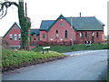
Looking along Cold Overton Road towards the former Methodist Chapel
This is now a private house
Image: © Roy Haworth
Taken: 29 Dec 2007
0.04 miles
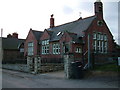
5

Former chapel, Knossington
Now a house.
Image: © Jonathan Thacker
Taken: 6 Apr 2021
0.05 miles


9

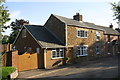
Semi-detached house on Larchwood Rise
Image: © Roger Templeman
Taken: 28 Sep 2015
0.10 miles
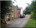
10
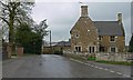
Main Street in Knossington
At the junction with Braunston Road.
Image: © Mat Fascione
Taken: 5 Apr 2008
0.11 miles