IMAGES TAKEN NEAR TO
Stud Road, OAKHAM, LE15 7WA
Introduction
This page details the photographs taken nearby to Stud Road, LE15 7WA by members of the Geograph project.
The Geograph project started in 2005 with the aim of publishing, organising and preserving representative images for every square kilometre of Great Britain, Ireland and the Isle of Man.

There are currently over 7.5m images from over14,400 individuals and you can help contribute to the project by visiting https://www.geograph.org.uk
Image Map
Images are licensed for reuse under creativecommons.org/licenses/by-sa/2.0
Notes
- Clicking on the map will re-center to the selected point.
- The higher the marker number, the further away the image location is from the centre of the postcode.
Image Listing (36 Images Found)
Images are licensed for reuse under creativecommons.org/licenses/by-sa/2.0
Image
Details
Distance
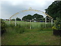
1
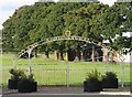
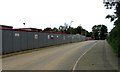
Rutland Agricultural Society Gateway
The Rutland Agricultural Society owns the playing fields by Rutland College.
Image: © Andrew Tatlow
Taken: 11 Sep 2009
0.03 miles
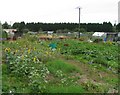
3
Huntsman Drive
The site of the new Catmose College buildings is to the left.
Image: © Andrew Tatlow
Taken: 5 Sep 2010
0.09 miles
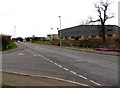
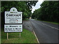
4
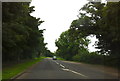
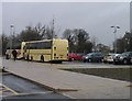
B640 leaving Oakham
Heading north west
Image: © Andrew Abbott
Taken: 1 Sep 2012
0.10 miles
8
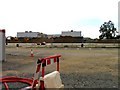
Catmose College new build
Catmose College hopes to move to new premises by the end of 2010.
Image: © Andrew Tatlow
Taken: 5 Sep 2010
0.15 miles