IMAGES TAKEN NEAR TO
Quorn Crescent, OAKHAM, LE15 7NB
Introduction
This page details the photographs taken nearby to Quorn Crescent, LE15 7NB by members of the Geograph project.
The Geograph project started in 2005 with the aim of publishing, organising and preserving representative images for every square kilometre of Great Britain, Ireland and the Isle of Man.

There are currently over 7.5m images from over14,400 individuals and you can help contribute to the project by visiting https://www.geograph.org.uk
Image Map (Loading...)


Getting Data...Please wait
Leaflet Map data © OpenStreetMap
Images are licensed for reuse under creativecommons.org/licenses/by-sa/2.0
Notes
- Clicking on the map will re-center to the selected point.
- The higher the marker number, the further away the image location is from the centre of the postcode.
Image Listing (4 Images Found)
Images are licensed for reuse under creativecommons.org/licenses/by-sa/2.0
Image
Details
Distance
1
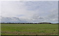
Boundary of Kendrick Barracks
Formerly RAF Cottesmore. MOD land, so difficult to avoid a 'cross-grid' photo!
Image: © Tim Heaton
Taken: 11 Mar 2020
0.04 miles
2

RAF Cottesmore
RAF Cottesmore was opened in 1938. Webpages to be found at http://www.raf.mod.uk/rafcottesmore/
Image: © Andrew Tatlow
Taken: 5 Oct 2007
0.22 miles
3

RAF Cottesmore perimeter fence
The perimeter fence of RAF Cottesmore crosses the corner of the square. Compare this with the perimeter fence on the other side of the base Image!
The spire of the church of St Mary the Virgin at Greetham is visible in the distance.
Image: © Andrew Tatlow
Taken: 5 Oct 2007
0.24 miles
4

RAF Cottesmore through the fence
A small wood and caravan storage are adjacent to the on-base housing.
Image: © Andrew Tatlow
Taken: 5 Oct 2007
0.25 miles