1
Rutland hedge
Image: © N Chadwick
Taken: 17 Feb 2015
0.09 miles
2
The B641 into Oakham
This used to be the main road through Oakham until the Bypass was built - Looking towards Swooning Bridge.
Image: © Jim Strang
Taken: 5 Sep 2010
0.10 miles
3
Pylon near The Grange
Image: © N Chadwick
Taken: 17 Feb 2015
0.11 miles
4
Old Milepost, B641, Uppingham Road, South of Oakham
Old Milepost, B641, Uppingham Road, South of Oakham
The milestone is located 250 north of the junction with the A6003, in the hedge at the back of the verge, on the east side of the road. Parish of Egleton (Rutland District). Cast iron post, erected by the Kettering & Nottingham, South District turnpike trust in the 19th century.
Inscription reads:-
UPPINGHAM / 6 / MILES : : LONDON / 95 / MILES : : OAKHAM / 1 / MILE
Milestone Society National ID: RU_UPOK06
National Survey of Wayside Features by The Milestone Society
Image: © thejackrustles
Taken: 19 Jan 2024
0.13 miles
5
Old Milepost, B641, Uppingham Road, South of Oakham
The milestone is located 250 north of the junction with the A6003, in the hedge at the back of the verge, on the east side of the road. Parish of Egleton (Rutland District). Cast iron post, erected by the Kettering & Nottingham, South District turnpike trust in the 19th century.
Inscription reads:-
UPPINGHAM / 6 / MILES : : LONDON / 95 / MILES : : OAKHAM / 1 / MILE
Milestone Society National ID: RU_UPOK06
Image: © Robin Hall
Taken: Unknown
0.13 miles
6
Old Milepost, B641, Uppingham Road, South of Oakham
The milestone is located 250 north of the junction with the A6003, in the hedge at the back of the verge, on the east side of the road. Parish of Egleton (Rutland District). Cast iron post, erected by the Kettering & Nottingham, South District turnpike trust in the 19th century. See also https://www.geograph.org.uk/photo/6098647
Inscription reads:-
UPPINGHAM / 6 / MILES : : LONDON / 95 / MILES : : OAKHAM / 1 / MILE
Milestone Society National ID: RU_UPOK06
Image: © Mike Nason
Taken: 29 Oct 2022
0.13 miles
7
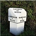
Old Cast Iron Iron Milepost
Old cast iron milepost near to Oakham, Rutland. For overall view see http://www.geograph.org.uk/photo/3274204
Image: © Keith Evans
Taken: 3 Dec 2012
0.14 miles
8
OS Cut Mark - Oakham, Number 4 Mount Pleasant
https://www.bench-marks.org.uk/bm74925
Image: © thejackrustles
Taken: 19 Jan 2024
0.15 miles
9
Cut mark on #4 Mount Pleasant
Ordnance Survey cut mark benchmark described on the Bench Mark Database at http://www.bench-marks.org.uk/bm74925
Image: © Roger Templeman
Taken: 5 Apr 2016
0.15 miles
10
Houses at Mount Pleasant, Uppingham Road
There is an OS benchmark
Imageon the road face, left hand corner, of the house at the junction with the abutting brick wall
Image: © Roger Templeman
Taken: 5 Apr 2016
0.15 miles


