IMAGES TAKEN NEAR TO
Old Mill Lane, LEICESTER, LE1 4AZ
Introduction
This page details the photographs taken nearby to Old Mill Lane, LE1 4AZ by members of the Geograph project.
The Geograph project started in 2005 with the aim of publishing, organising and preserving representative images for every square kilometre of Great Britain, Ireland and the Isle of Man.

There are currently over 7.5m images from over14,400 individuals and you can help contribute to the project by visiting https://www.geograph.org.uk
Image Map
Images are licensed for reuse under creativecommons.org/licenses/by-sa/2.0
Notes
- Clicking on the map will re-center to the selected point.
- The higher the marker number, the further away the image location is from the centre of the postcode.
Image Listing (350 Images Found)
Images are licensed for reuse under creativecommons.org/licenses/by-sa/2.0
Image
Details
Distance
1
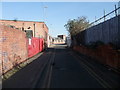
Cycle Route 6 along Old Mill Lane, Leicester
Image: © Tim Heaton
Taken: 26 Feb 2012
0.02 miles
3
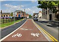
Cycle lane along the A50 at Frog Island, Leicester
Image: © Mat Fascione
Taken: 5 May 2024
0.06 miles
4
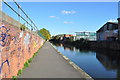
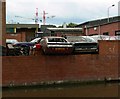
The Grand Union Canal
The canal was a major transport hub before the railways arrives, it is now popular with boaters and walkers alike.
http://en.wikipedia.org/wiki/Grand_Union_Canal
Image: © Ashley Dace
Taken: 17 Oct 2010
0.07 miles
5
Factories along the Grand Union Canal, Leicester
Image: © Mat Fascione
Taken: 17 Jun 2007
0.07 miles
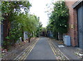
6
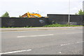
Boarded up development site on SW side of Northgate Street
Previously a railway bridge crossed here with railway tracks behind
Image: © Roger Templeman
Taken: 11 May 2018
0.07 miles
7
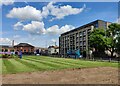
Lawns at the entrance to Waterside
The Waterside is a new development of 288 contemporary homes and apartments in the Frog Island area of Leicester.
Image: © Mat Fascione
Taken: 5 May 2024
0.07 miles
8
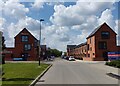
Pingle Street in Frog Island, Leicester
The Waterside is a new development of 288 contemporary homes and apartments in the Frog Island area of Leicester.
Image: © Mat Fascione
Taken: 5 May 2024
0.07 miles
9
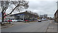
Northgate Street, Leicester
Northgate Street is a main arterial route out of the city centre.
Image: © Peter Mackenzie
Taken: 3 Apr 2018
0.07 miles
10
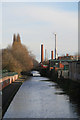
Grand Union Canal, Leicester
Frog Island is to the left between the Canal and the Soar. There is distant industry with emissions from at least one chimney.
Image: © Chris Allen
Taken: 4 Dec 2011
0.07 miles