IMAGES TAKEN NEAR TO
Sandpit Lane, MELTON MOWBRAY, LE14 4NX

Introduction

This page details the photographs taken nearby to Sandpit Lane, LE14 4NX by members of the Geograph project.

The Geograph project started in 2005 with the aim of publishing, organising and preserving representative images for every square kilometre of Great Britain, Ireland and the Isle of Man.

There are currently over 7.5m images from over14,400 individuals and you can help contribute to the project by visiting https://www.geograph.org.uk

Image Map


Images are licensed for reuse under creativecommons.org/licenses/by-sa/2.0
Notes
  • Clicking on the map will re-center to the selected point.
  • The higher the marker number, the further away the image location is from the centre of the postcode.

Image Listing (94 Images Found)

Images are licensed for reuse under creativecommons.org/licenses/by-sa/2.0
  • ...
Image
Details
Distance
1
Houses on Sand Pit Lane, Long Clawson
Image: © JThomas Taken: 21 Jun 2014
0.03 miles
2
Sand Pit Lane, Long Clawson
Heading south.
Image: © JThomas Taken: 21 Jun 2014
0.04 miles
3
Footpath to Kings Road
Image: © Andrew Tatlow Taken: 23 May 2020
0.05 miles
4
Footpath and houses, Long Clawson
Image: © Jonathan Thacker Taken: 25 Nov 2021
0.05 miles
5
Cemetery gates from Sand Pit Lane
Image: © Andrew Tatlow Taken: 23 May 2020
0.06 miles
6
Cemetery gates from the inside
Image: © Andrew Tatlow Taken: 23 May 2020
0.06 miles
7
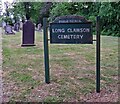
Long Clawson Cemetery sign
It looked ready for a coat of paint!
Image: © Andrew Tatlow Taken: 23 May 2020
0.06 miles
8
Cemetery sign and gravestones
Image: © Andrew Tatlow Taken: 23 May 2020
0.06 miles
9
Gravestone deemed dangerous 003
The inscription reads "In Loving Memory of ADA MARY the Beloved Wife of" and presumably the base hidden beneath the toppled memorial had the husbands name. Rather sad that the Parish Council deems the memorial dangerous and topples it with a notice affixed with instructions to contact the Clerk. See Image and Image also.
Image: © Andrew Tatlow Taken: 23 May 2020
0.06 miles
10
Gravestone deemed dangerous 002
See Image and Image also.
Image: © Andrew Tatlow Taken: 23 May 2020
0.06 miles
  • ...