IMAGES TAKEN NEAR TO
Hose, MELTON MOWBRAY, LE14 4JX
Introduction
This page details the photographs taken nearby to LE14 4JX by members of the Geograph project.
The Geograph project started in 2005 with the aim of publishing, organising and preserving representative images for every square kilometre of Great Britain, Ireland and the Isle of Man.

There are currently over 7.5m images from over14,400 individuals and you can help contribute to the project by visiting https://www.geograph.org.uk
Image Map
Images are licensed for reuse under creativecommons.org/licenses/by-sa/2.0
Notes
- Clicking on the map will re-center to the selected point.
- The higher the marker number, the further away the image location is from the centre of the postcode.
Image Listing (17 Images Found)
Images are licensed for reuse under creativecommons.org/licenses/by-sa/2.0
Image
Details
Distance
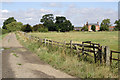
1
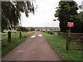
Private Road
But it's a public footpath.
Image: © Jonathan Thacker
Taken: 29 Aug 2020
0.02 miles
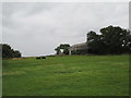
2
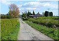
Track near Mount Pleasant
The house is called The Paddocks.
Image: © Mat Fascione
Taken: 14 Apr 2014
0.02 miles
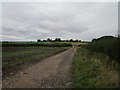
3
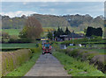
Track to Mount Pleasant and the Harby Hills
Image: © Mat Fascione
Taken: 14 Apr 2014
0.02 miles
4
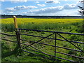
Oil seed rape crop near Mount Pleasant
Image: © Mat Fascione
Taken: 14 Apr 2014
0.03 miles
6
Rusting digger by the track at Mount Pleasant
Image: © Mat Fascione
Taken: 14 Apr 2014
0.05 miles
8
Footpath to Hose
Looking towards Mount Pleasant.
Image: © Jonathan Thacker
Taken: 29 Aug 2020
0.07 miles
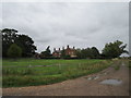
9
Road to Mount Pleasant
Mount Pleasant is the name of this large farm to the south east of Hose in the Vale of Belvoir.
Image: © Kate Jewell
Taken: 11 Aug 2010
0.07 miles
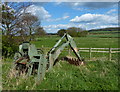
10
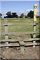
Stile at Mount Pleasant
Looking towards Mount Pleasant farmhouse along one of the many footpaths in this area.
Image: © Kate Jewell
Taken: 11 Aug 2010
0.07 miles