IMAGES TAKEN NEAR TO
Hose Lane, MELTON MOWBRAY, LE14 4BJ
Introduction
This page details the photographs taken nearby to Hose Lane, LE14 4BJ by members of the Geograph project.
The Geograph project started in 2005 with the aim of publishing, organising and preserving representative images for every square kilometre of Great Britain, Ireland and the Isle of Man.

There are currently over 7.5m images from over14,400 individuals and you can help contribute to the project by visiting https://www.geograph.org.uk
Image Map
Images are licensed for reuse under creativecommons.org/licenses/by-sa/2.0
Notes
- Clicking on the map will re-center to the selected point.
- The higher the marker number, the further away the image location is from the centre of the postcode.
Image Listing (7 Images Found)
Images are licensed for reuse under creativecommons.org/licenses/by-sa/2.0
Image
Details
Distance
2
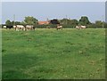
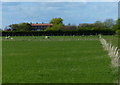
Farmland near Hose
Looking towards Hose Lane Farm, now a specialist poultry farm.
Image: © Alan Murray-Rust
Taken: 19 Oct 2020
0.19 miles
4
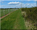
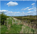
Public bridleway near the village of Hose
Image: © Mat Fascione
Taken: 14 Apr 2014
0.24 miles
6
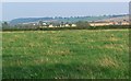
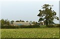
Vale of Belvoir farmland
Close to the Leicestershire village of Hose.
Image: © Mat Fascione
Taken: 30 Aug 2008
0.25 miles