IMAGES TAKEN NEAR TO
Pickwell Road, MELTON MOWBRAY, LE14 2XD
Introduction
This page details the photographs taken nearby to Pickwell Road, LE14 2XD by members of the Geograph project.
The Geograph project started in 2005 with the aim of publishing, organising and preserving representative images for every square kilometre of Great Britain, Ireland and the Isle of Man.

There are currently over 7.5m images from over14,400 individuals and you can help contribute to the project by visiting https://www.geograph.org.uk
Image Map
Images are licensed for reuse under creativecommons.org/licenses/by-sa/2.0
Notes
- Clicking on the map will re-center to the selected point.
- The higher the marker number, the further away the image location is from the centre of the postcode.
Image Listing (13 Images Found)
Images are licensed for reuse under creativecommons.org/licenses/by-sa/2.0
Image
Details
Distance
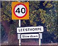
5
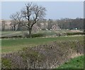
View towards Alpine Cottages
Part of the tiny Leicestershire village of Leesthorpe.
Image: © Mat Fascione
Taken: 21 Apr 2008
0.04 miles
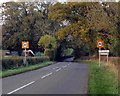
6
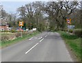
Approaching Leesthorpe
Travelling north along Leesthorpe Road.
Image: © Mat Fascione
Taken: 21 Apr 2008
0.05 miles
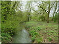
7
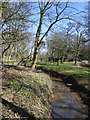
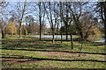
Stream at Leesthorpe Bridge
Image: © Kate Jewell
Taken: 5 Apr 2006
0.07 miles
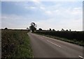
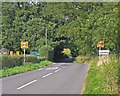
10
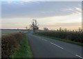
Leesthorpe Road towards Pickwell
The large tree on the right is approximately on the square boundary.
Image: © Andrew Tatlow
Taken: 5 Nov 2018
0.13 miles