IMAGES TAKEN NEAR TO
Great Dalby Road, MELTON MOWBRAY, LE14 2TL
Introduction
This page details the photographs taken nearby to Great Dalby Road, LE14 2TL by members of the Geograph project.
The Geograph project started in 2005 with the aim of publishing, organising and preserving representative images for every square kilometre of Great Britain, Ireland and the Isle of Man.

There are currently over 7.5m images from over14,400 individuals and you can help contribute to the project by visiting https://www.geograph.org.uk
Image Map
Images are licensed for reuse under creativecommons.org/licenses/by-sa/2.0
Notes
- Clicking on the map will re-center to the selected point.
- The higher the marker number, the further away the image location is from the centre of the postcode.
Image Listing (12 Images Found)
Images are licensed for reuse under creativecommons.org/licenses/by-sa/2.0
Image
Details
Distance
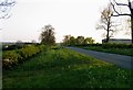
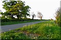
2
Towards South Croxton
Headland House is to the left
Image: © Andrew Tatlow
Taken: 18 Dec 2008
0.08 miles
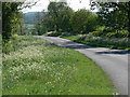

9

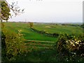
Leicestershire countryside
View south-east from Ashby Folville Road near Headland Farm.
Image: © Alan Murray-Rust
Taken: 23 May 2018
0.15 miles
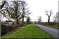
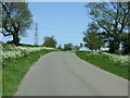
10
Towards Great Dalby
The road gets just into the corner of the square!
Image: © Andrew Tatlow
Taken: 28 Apr 2011
0.15 miles