IMAGES TAKEN NEAR TO
Main Road, MELTON MOWBRAY, LE14 2LN
Introduction
This page details the photographs taken nearby to Main Road, LE14 2LN by members of the Geograph project.
The Geograph project started in 2005 with the aim of publishing, organising and preserving representative images for every square kilometre of Great Britain, Ireland and the Isle of Man.

There are currently over 7.5m images from over14,400 individuals and you can help contribute to the project by visiting https://www.geograph.org.uk
Image Map
Images are licensed for reuse under creativecommons.org/licenses/by-sa/2.0
Notes
- Clicking on the map will re-center to the selected point.
- The higher the marker number, the further away the image location is from the centre of the postcode.
Image Listing (11 Images Found)
Images are licensed for reuse under creativecommons.org/licenses/by-sa/2.0
Image
Details
Distance
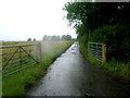
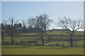
1
Track to Hall Farm
Hall Farm is farmed by the Brooksby Melton College.
Image: © Andrew Tatlow
Taken: 5 Aug 2010
0.04 miles
2
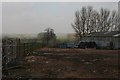
Yard behind Hall farm on the Brooksby Melton College Campus
Image: © Chris
Taken: 18 Mar 2015
0.07 miles
3
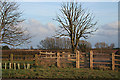
New fence at Brooksby Grange Farm
The building of the Rearsby bypass necessitated the re-siting of many boundaries. This one has a solid looking gate included.
Image: © Kate Jewell
Taken: 29 Mar 2006
0.13 miles
9
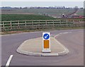
Entrance to Brooksby Quarry
A new Lafarge Aggregates quarry extracting sand and gravel.
Image: © Mat Fascione
Taken: 15 Mar 2009
0.19 miles