IMAGES TAKEN NEAR TO
Wyndham Avenue, MELTON MOWBRAY, LE13 0RE
Introduction
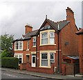
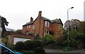
This page details the photographs taken nearby to Wyndham Avenue, LE13 0RE by members of the Geograph project.
The Geograph project started in 2005 with the aim of publishing, organising and preserving representative images for every square kilometre of Great Britain, Ireland and the Isle of Man.

There are currently over 7.5m images from over14,400 individuals and you can help contribute to the project by visiting https://www.geograph.org.uk
Image Map (Loading...)


Getting Data...Please wait
Leaflet Map data © OpenStreetMap
Images are licensed for reuse under creativecommons.org/licenses/by-sa/2.0
Notes
- Clicking on the map will re-center to the selected point.
- The higher the marker number, the further away the image location is from the centre of the postcode.
Image Listing (374 Images Found)
Images are licensed for reuse under creativecommons.org/licenses/by-sa/2.0
Image
Details
Distance

9

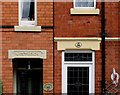
Penrose and Westhoe signs Craven Street
Image: © Andrew Tatlow
Taken: 8 Jul 2011
0.05 miles
10
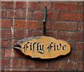
Melbray and Briar Brae signs Craven Street
Image: © Andrew Tatlow
Taken: 8 Jul 2011
0.05 miles