IMAGES TAKEN NEAR TO
Barker Crescent, MELTON MOWBRAY, LE13 0QW
Introduction
This page details the photographs taken nearby to Barker Crescent, LE13 0QW by members of the Geograph project.
The Geograph project started in 2005 with the aim of publishing, organising and preserving representative images for every square kilometre of Great Britain, Ireland and the Isle of Man.

There are currently over 7.5m images from over14,400 individuals and you can help contribute to the project by visiting https://www.geograph.org.uk
Image Map (Loading...)


Getting Data...Please wait
Leaflet Map data © OpenStreetMap
Images are licensed for reuse under creativecommons.org/licenses/by-sa/2.0
Notes
- Clicking on the map will re-center to the selected point.
- The higher the marker number, the further away the image location is from the centre of the postcode.
Image Listing (189 Images Found)
Images are licensed for reuse under creativecommons.org/licenses/by-sa/2.0
Image
Details
Distance
4
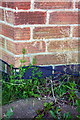
Benchmark on #99 Dalby Road
Ordnance Survey cut mark benchmark described on the Bench Mark Database at http://www.bench-marks.org.uk/bm75364
Image: © Roger Templeman
Taken: 3 May 2016
0.05 miles
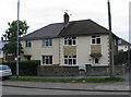
5
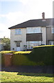
#99 Dalby Road
There is an OS benchmark Image on bricks below the ground floor bay window
Image: © Roger Templeman
Taken: 3 May 2016
0.05 miles
7
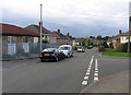
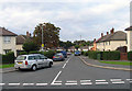
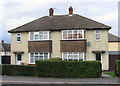
Barker Crescent/Brownlow Crescent junction
Image: © Andrew Tatlow
Taken: 13 Oct 2015
0.05 miles
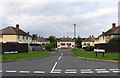
10
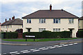
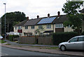
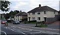
Houses at the end of Barker Crescent
Image: © Andrew Tatlow
Taken: 13 Oct 2015
0.05 miles