1
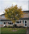
A Maple on Sycamore Road
A typical domestic scene for this square
Image: © Chris J Dixon
Taken: 11 Oct 2001
0.01 miles
2
Twentylands Drive
A cul-de-sac to the west of East Leake village centre.
Image: © Jonathan Billinger
Taken: 13 Jun 2008
0.13 miles
3
Sycamore Road, East Leake
East Leake is a village that grew rapidly in the second half of the 20th century and continues to do so; the population at the 2011 census was 6,337. The houses here, built around 1970, are typical of much of the housing stock to the south-west of the village centre.
Image: © Stephen McKay
Taken: 13 May 2022
0.13 miles
4
Sycamore Road, East Leake
A suburban estate to the west of East Leake village centre.
Image: © Jonathan Billinger
Taken: 13 Jun 2008
0.14 miles
5
Balancing pond and footbridge
Flood management for a new housing development.
Image: © Ian Calderwood
Taken: 25 Aug 2018
0.14 miles
6
East Leake Station Bridge
This was once the site of East Leake Station. It had an island platform reached by a flight of steps which rose through the left hand (Southern) abutment. Although since blocked, the entrance arch is still visible. There is a view at the time of construction, taken from the other direction, at http://www.railwayarchive.org.uk/map/getobjectmap.php?rnum=L1835&mapid=453323.jpg&mlsref=1031&cmn=East%20Leake&pn=1&mp=1&all=no
Image: © Chris J Dixon
Taken: 14 May 2005
0.17 miles
7
Fingerpost, Woodgate Road/Rempstone Road
Notts C C traditional cast-iron with annulus finial.
Image: © Alan Murray-Rust
Taken: 15 May 2014
0.18 miles
8
Woodgate Road heading south-west out of East Leake
The Z4 bus service runs between East Leake, Kegworth (East Midlands Airport) and Sutton Bonington, and is a Nottsbus On Demand service.
Image: © Tim Heaton
Taken: 5 May 2024
0.19 miles
9
New Housing Development at East Leake
Image: © Anthony Parkes
Taken: 3 Aug 2015
0.19 miles
10
Benchmark on Station Road railway bridge, East Leake
Image: © John Beniston
Taken: 23 Jul 2020
0.21 miles


