IMAGES TAKEN NEAR TO
LE12 6BT
Introduction
This page details the photographs taken nearby to LE12 6BT by members of the Geograph project.
The Geograph project started in 2005 with the aim of publishing, organising and preserving representative images for every square kilometre of Great Britain, Ireland and the Isle of Man.

There are currently over 7.5m images from over14,400 individuals and you can help contribute to the project by visiting https://www.geograph.org.uk
Image Map
Images are licensed for reuse under creativecommons.org/licenses/by-sa/2.0
Notes
- Clicking on the map will re-center to the selected point.
- The higher the marker number, the further away the image location is from the centre of the postcode.
Image Listing (30 Images Found)
Images are licensed for reuse under creativecommons.org/licenses/by-sa/2.0
Image
Details
Distance
3
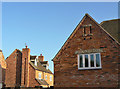
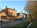
Modern housing, old style, at Manor Court
A very commendable effort has been made to match this modern development at the east end of Wymeswold with traditional local styles of building. The main giveaway that this is modern is that the brickwork is in stretcher bond, an almost certain indication of cavity wall construction. One hopes that the slots in the gables are suitably pigeon proof!
Image: © Alan Murray-Rust
Taken: 12 Dec 2011
0.09 miles
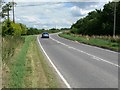
4
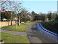
Brook Street
The outer end of the village, with mainly 20th century houses.
Image: © Alan Murray-Rust
Taken: 12 Dec 2011
0.11 miles
5
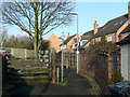
Footpath to East Road
Although modernised, this alley way is an old established link between Brook Street and East Road.
Image: © Alan Murray-Rust
Taken: 12 Dec 2011
0.12 miles
6
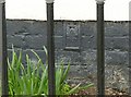
Flush bracket bench mark, Brook Street, Wymeswold
On the more distant house with a white gable facing the road in this picture http://www.geograph.org.uk/photo/2733778
Image: © Alan Murray-Rust
Taken: 20 Feb 2017
0.12 miles
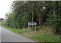
7
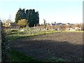
Allotments on East Road
A small patch of allotments which appear on maps from the late 19th century. They may represent gardens associated with specific houses in the village which had no garden attached.
Image: © Alan Murray-Rust
Taken: 12 Dec 2011
0.14 miles
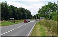
8
Brook Street
These houses mark the end of the older part of the village before further development in the 20th century.
Image: © Alan Murray-Rust
Taken: 12 Dec 2011
0.14 miles
9
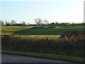
Bumps in the field
Some of the earthworks represent the remains of the three (possibly four) manor houses in the village. This one disappeared by the eighteenth century. The extent of the earthworks gives the impression that some quarrying, possible for clay may have occurred later. This is certainly true in relation to Clay Street at the opposite end of the village.
Image: © Alan Murray-Rust
Taken: 12 Dec 2011
0.14 miles