IMAGES TAKEN NEAR TO
Colts Close, HINCKLEY, LE10 2HH
Introduction
This page details the photographs taken nearby to Colts Close, LE10 2HH by members of the Geograph project.
The Geograph project started in 2005 with the aim of publishing, organising and preserving representative images for every square kilometre of Great Britain, Ireland and the Isle of Man.

There are currently over 7.5m images from over14,400 individuals and you can help contribute to the project by visiting https://www.geograph.org.uk
Image Map
Images are licensed for reuse under creativecommons.org/licenses/by-sa/2.0
Notes
- Clicking on the map will re-center to the selected point.
- The higher the marker number, the further away the image location is from the centre of the postcode.
Image Listing (13 Images Found)
Images are licensed for reuse under creativecommons.org/licenses/by-sa/2.0
Image
Details
Distance
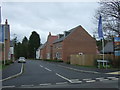
1
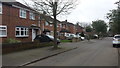
Houses in Sketchley
Typical housing in this area in south Hinckley.
Image: © Peter Mackenzie
Taken: 21 Feb 2017
0.06 miles
2
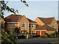
Troon Way, Burbage
Situated on the western edge of Burbage, Troon Way is part of a small estate of new executive-style houses close to Sketchley Old Village. The roads have been named after famous golf courses.
Image: © Stephen McKay
Taken: 22 Oct 2006
0.07 miles
3
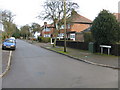
Welbeck Avenue
Taken at the junction with Beechwood Avenue.
Image: © Peter Whatley
Taken: 11 Dec 2008
0.14 miles
5
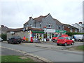
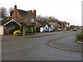
Sketchley Post Office
Showing position of postbox No. LE10 17.
Image: © JThomas
Taken: 25 Feb 2017
0.17 miles
6
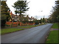
Beechwood Avenue
Taken from the junction with Welbeck Avenue.
Image: © Peter Whatley
Taken: 11 Dec 2008
0.19 miles
9
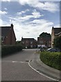
Sunloch Close, Burbage
New housing development off Three Pots Road.
Image: © JThomas
Taken: 25 Feb 2017
0.21 miles
10
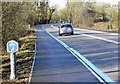
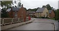
A5 Watling Street
Close to the southern edge of Hinckley, on the border of Leicestershire and Warwickshire.
Image: © Mat Fascione
Taken: 12 Jan 2008
0.24 miles