IMAGES TAKEN NEAR TO
Leicester Road, HINCKLEY, LE10 1LU
Introduction
This page details the photographs taken nearby to Leicester Road, LE10 1LU by members of the Geograph project.
The Geograph project started in 2005 with the aim of publishing, organising and preserving representative images for every square kilometre of Great Britain, Ireland and the Isle of Man.

There are currently over 7.5m images from over14,400 individuals and you can help contribute to the project by visiting https://www.geograph.org.uk
Image Map
Images are licensed for reuse under creativecommons.org/licenses/by-sa/2.0
Notes
- Clicking on the map will re-center to the selected point.
- The higher the marker number, the further away the image location is from the centre of the postcode.
Image Listing (16 Images Found)
Images are licensed for reuse under creativecommons.org/licenses/by-sa/2.0
Image
Details
Distance
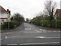
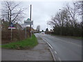
1
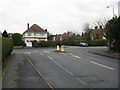
Stoneygate Drive meets Leicester Road, Hinckley
Image: © Peter Whatley
Taken: 11 Dec 2008
0.03 miles
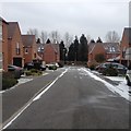
2
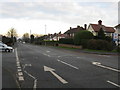
Leicester Road, Hinckley
At the junctions with Bradfield Road and Stoneygate Road.
Image: © Peter Whatley
Taken: 11 Dec 2008
0.08 miles
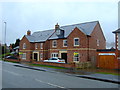
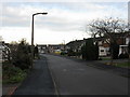
6
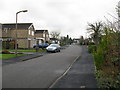
Kirfield Road, Hinckley, looking south-west
Image: © Peter Whatley
Taken: 11 Dec 2008
0.12 miles
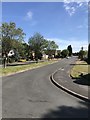
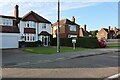
9
Entering Hinckley
Heading south west on Leicester Road (B4668).
Image: © JThomas
Taken: 25 Feb 2017
0.18 miles
10
Kirfield Road, Hinckley, looking north-east
Image: © Peter Whatley
Taken: 11 Dec 2008
0.18 miles