IMAGES TAKEN NEAR TO
Knighton Road, PRESTEIGNE, LD8 2ET

Introduction

This page details the photographs taken nearby to Knighton Road, LD8 2ET by members of the Geograph project.

The Geograph project started in 2005 with the aim of publishing, organising and preserving representative images for every square kilometre of Great Britain, Ireland and the Isle of Man.

There are currently over 7.5m images from over14,400 individuals and you can help contribute to the project by visiting https://www.geograph.org.uk

Image Map


Images are licensed for reuse under creativecommons.org/licenses/by-sa/2.0
Notes
  • Clicking on the map will re-center to the selected point.
  • The higher the marker number, the further away the image location is from the centre of the postcode.

Image Listing (10 Images Found)

Images are licensed for reuse under creativecommons.org/licenses/by-sa/2.0
Image
Details
Distance
1
Boultisbrooke Bridge
Plaque on the newer of the bridges over the Lugg.
Image: © Richard Webb Taken: 25 Jul 2007
0.04 miles
2
B4355 at Boutisbrooke Bridge
Image: © Peter Whatley Taken: 1 Sep 2011
0.05 miles
3
B4355 southwest of Boutisbrooke
Image: © Stuart Logan Taken: 21 Sep 2013
0.08 miles
4
Allotments off Knighton Road
Image: © Oliver Dixon Taken: 5 Aug 2021
0.09 miles
5
River Lugg
The Lugg from Boultisbrooke Bridge, just before it leaves Wales. As for most of its length the river is lined with alders.
Image: © Richard Webb Taken: 25 Jul 2007
0.10 miles
6
Sheep Music: the aftermath
Knighton Road, Presteigne after the festival.
Image: © Richard Webb Taken: 25 Jul 2007
0.18 miles
7
Knighton Road, Presteigne
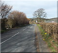
Looking north along the B4355 Knighton Road. The wooden fence on the left is part of this http://www.geograph.org.uk/photo/3920660 gas installation enclosure.
Image: © Jaggery Taken: 19 Mar 2014
0.19 miles
8
Sheep Music: the aftermath
Presteigne's Sheep Music festival had the misfortune of coinciding with the downpours that led to widespread flooding in July 2007. The site, on the edge of the town is now churned up, presumably by tractors extracting vehicles. At one time the campsite was threatened by the rising waters of the Lugg.
Image: © Richard Webb Taken: 25 Jul 2007
0.21 miles
9
1st Presteigne Scout Group hall
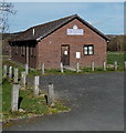
Set back from the east side of the B4355 Knighton Road.
Image: © Jaggery Taken: 19 Mar 2014
0.22 miles
10
Gas installation enclosure, Presteigne
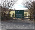
Located on the west side of the B4355 Knighton Road. A Transco notice gives an 0800 (free) phone number to ring before beginning any work on or within 10 metres of the site, or in an emergency.
Image: © Jaggery Taken: 19 Mar 2014
0.24 miles