1
George VI postbox, Greenfield Road Presteigne
The box is in the wall on the left side of the road here. http://www.geograph.org.uk/photo/3895877
Image: © Jaggery
Taken: 19 Mar 2014
0.04 miles
2
Orchard Close bungalows, Presteigne
Viewed across Greenfield Road.
Image: © Jaggery
Taken: 19 Mar 2014
0.07 miles
3
John Beddoes School, Presteigne
Looking south along Broadaxe.
Image: © Jaggery
Taken: 19 Mar 2014
0.07 miles
4
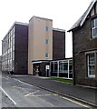
Greenfield Road Presteigne
This is the B4356 in the SE of Presteigne. The steps on the right lead up to a bowling green.
A King George VI postbox http://www.geograph.org.uk/photo/3895878 is in the wall on the left.
Image: © Jaggery
Taken: 19 Mar 2014
0.07 miles
5
Entrance to John Beddoes School, Presteigne
From the street named Broadaxe.
Image: © Jaggery
Taken: 19 Mar 2014
0.08 miles
6
SE corner of John Beddoes School, Presteigne
Viewed across the street named Broadaxe.
Image: © Jaggery
Taken: 19 Mar 2014
0.08 miles
7
Older part of John Beddoes School, Presteigne
Viewed from Broadaxe. This is the NE corner of the school which as Presteigne County Secondary School in 1869 moved into these new buildings on the site previously occupied by the County Gaol.
Image: © Jaggery
Taken: 19 Mar 2014
0.08 miles
8
Sports ground on the eastern edge of Presteigne
Image: © Phil Catterall
Taken: 11 Aug 2006
0.09 miles
9
Presteigne buildings [14]
Founded in 1565 by John Beddoes, a wealthy woollen manufacturer, the school is the second oldest grammar School in Wales. The school moved to its current site on Broadaxe Lane in 1907. It merged with Knighton Secondary Modern School in 1970 to form a comprehensive school. In 2014, the school closed, to reopen as the John Beddoes Campus of Newtown High School. The buildings are mostly constructed of coursed rubble stone with ashlar dressings under slate roofs.
Presteigne is a market town, set on the south bank of the River Lugg, some 19 miles northwest of Hereford and 16 miles east of Llandrindod Wells. The Welsh/English border wraps around three sides of the town, which probably began as a small settlement around a Minster church. Formerly the county town of the historic county of Radnorshire, it remains quiet, picturesque and unspoilt.
Image: © Michael Dibb
Taken: 2 Jun 2021
0.09 miles
10
Broadaxe, Presteigne
Newtown High School, John Beddoes Campus to the left, East Radnor Leisure Centre to the right.
Image: © Oliver Dixon
Taken: 6 Aug 2021
0.10 miles


![Presteigne buildings [14]](https://s1.geograph.org.uk/geophotos/06/95/19/6951933_1c494e19_120x120.jpg)
