1
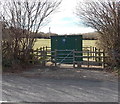
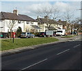
Gas installation enclosure, Presteigne
Located on the west side of the B4355 Knighton Road. A Transco notice gives an 0800 (free) phone number to ring before beginning any work on or within 10 metres of the site, or in an emergency.
Image: © Jaggery
Taken: 19 Mar 2014
0.02 miles
2
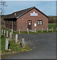
1st Presteigne Scout Group hall
Set back from the east side of the B4355 Knighton Road.
Image: © Jaggery
Taken: 19 Mar 2014
0.04 miles
3
Playground at the western edge of Presteigne
A board on the Knighton Road side of the playground records its opening on May 16th 1995.
Image: © Jaggery
Taken: 19 Mar 2014
0.04 miles
4
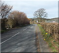
Knighton Road, Presteigne
Looking north along the B4355 Knighton Road.
The wooden fence on the left is part of this http://www.geograph.org.uk/photo/3920660 gas installation enclosure.
Image: © Jaggery
Taken: 19 Mar 2014
0.05 miles
5
B4356/B4355 junction, Presteigne
Image: © Peter Whatley
Taken: 1 Sep 2011
0.05 miles
6
B4355 junction with B4356
Image: © Stuart Logan
Taken: 21 Sep 2013
0.06 miles
7
Sheep Music: the aftermath
Knighton Road, Presteigne after the festival.
Image: © Richard Webb
Taken: 25 Jul 2007
0.06 miles
8
B4356 heads away from Presteigne
Viewed from the corner of Warden Close, opposite the B4355 Knighton Road junction.
Image: © Jaggery
Taken: 19 Mar 2014
0.07 miles
9
Sheep Music: the aftermath
Presteigne's Sheep Music festival had the misfortune of coinciding with the downpours that led to widespread flooding in July 2007. The site, on the edge of the town is now churned up, presumably by tractors extracting vehicles. At one time the campsite was threatened by the rising waters of the Lugg.
Image: © Richard Webb
Taken: 25 Jul 2007
0.08 miles
10
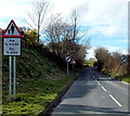
Western boundary of Presteigne
The bilingual boundary sign alongside Knighton Road shows that the Welsh name of the town is Llanandras.
Image: © Jaggery
Taken: 19 Mar 2014
0.09 miles


