1
Presteigne - police station entrance and houses
Image: © Peter Whatley
Taken: 1 Sep 2011
0.00 miles
2
Nos.44 (Cromwell Lodge) & 45 Hereford Street
The Cadw Building ID: 8867 for this Grade II listed builting cites its name as 'Cottage' not 'Lodge', but I've opted for what was above the front door.
Image: © Stuart Logan
Taken: 21 Sep 2013
0.00 miles
3
Presteigne buildings [30]
Presteigne Baptist Church in Hereford Street is dated 1885. Constructed in coursed rubble stone with an ashlar front and dressings, all under a slate roof.
Presteigne is a market town, set on the south bank of the River Lugg, some 19 miles northwest of Hereford and 16 miles east of Llandrindod Wells. The Welsh/English border wraps around three sides of the town, which probably began as a small settlement around a Minster church. Formerly the county town of the historic county of Radnorshire, it remains quiet, picturesque and unspoilt.
Image: © Michael Dibb
Taken: 2 Jun 2021
0.01 miles
4
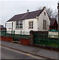
Presteigne Youth Centre
Located in Hereford Street, Presteigne Youth Centre is run entirely
by local volunteers and financed by local donations and fund raising.
Image: © Jaggery
Taken: 19 Mar 2014
0.01 miles
5
Presteigne houses [35]
Cromwell Cottage, number 44 Hereford Street and Cromwell Lodge, number 45 Hereford Street are a divided late 16th or early 17th century house with a cross wing. Timber framed with plaster infill, under a slate roof. Listed, grade II, with details at: https://cadwpublic-api.azurewebsites.net/reports/listedbuilding/FullReport?lang=&id=8867
Presteigne is a market town, set on the south bank of the River Lugg, some 19 miles northwest of Hereford and 16 miles east of Llandrindod Wells. The Welsh/English border wraps around three sides of the town, which probably began as a small settlement around a Minster church. Formerly the county town of the historic county of Radnorshire, it remains quiet, picturesque and unspoilt.
Image: © Michael Dibb
Taken: 2 Jun 2021
0.01 miles
6
Cromwell Cottage, Presteigne
Dates from about 1600 https://coflein.gov.uk/en/site/81283/
Image: © Jonathan Thacker
Taken: 22 Aug 2022
0.01 miles
7
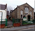
Presteigne Baptist Church
Located in Hereford Street.
Image: © Jaggery
Taken: 19 Mar 2014
0.02 miles
8
Presteigne Baptist Church
Dated 1885 https://coflein.gov.uk/en/site/8250/
Image: © Jonathan Thacker
Taken: 22 Aug 2022
0.02 miles
9
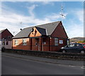
Presteigne Police Station
The Hereford Street station is part of the Dyfed-Powys Police force.
Image: © Jaggery
Taken: 19 Mar 2014
0.02 miles
10
Presteigne Police Station, Hereford Street, Presteigne, Powys
The Police Station is operated by Dyfed-Powys Police. To the side and behind it is a public car park with two charging points for electric vehicles.
Image: © P L Chadwick
Taken: 10 Jul 2021
0.02 miles


![Presteigne buildings [30]](https://s2.geograph.org.uk/geophotos/06/95/19/6951910_42b7a96c_120x120.jpg)

![Presteigne houses [35]](https://s1.geograph.org.uk/geophotos/06/95/19/6951953_483192eb_120x120.jpg)


